Dear reader: This article contains links to products and services that I may be compensated for, at no extra cost to you.
The Ollantaytambo Ruins (Ollantaytambo Archaeological Site) in Peru’s Sacred Valley is second in importance only to Machu Picchu itself.
These prominent ruins overlooking Ollantaytambo townsite were the site of the only major Inca defeat of Spanish forces. Today, they are also one of the most accessible ruins around Cusco because you can walk to them right from the townsite.
Along with the ruins in Pisac nearby, the Ollantaytambo ruins are an absolute must-visit for anyone on their way to Machu Picchu (and yes, I recommend visiting these ones before MP!)
If you’re planning to visit the ruins on your own like I did, I’ve typed up this self-guided tour. This will include some recent updates and closed areas in the ruins, after I found a lot of the information online was incorrect.
I absolutely loved Ollantaytambo. It was my favorite Sacred Valley town. I highly recommend staying there for at least a few days (I spend four full days and never ran out of things to do in Ollantaytambo, including many more smaller ruins around town). I also recommend these Ollantaytambo restaurants!
Table of Contents
Ollantaytambo Ruins Fast Facts
- Local Name: Parque Arqueológico Ollantaytambo (Ollantaytambo Archaeological Park) – Peruivians prefer to say “archaeological park” over “ruins”. Ollantaytambo is pronounced “O-yan-tay-tombo” and often shortened to “Ollanta”.
- Elevation: The town and base of the ruins sit at approximately 2792 m (9160 ft). This is 542 m (1778 ft) higher than Machu Picchu but 427 m (1401 ft) lower than Cusco. This makes Ollantaytambo a great place to acclimatize for a few days for those flying in to Cusco (see my guide to Cusco for more info).
- Location: At the base of a mountain at the western end of Ollantaytambo town. On foot, the ruins are a 5-minute walk from the Plaza de Armas (main square) or Kamma Guesthouse (I highly recommend this guesthouse in town, see on Booking / Agoda / TripAdvisor). The ruins are a 20-minute walk (uphill) from the Ollantaytambo train station.
- Age: Around 1450, Pachacuti (builder of Marchu Picchu) razed Ollantaytambo and built the fortress & ceremonial site.
- Key Moment in History: When the Spanish took Cusco, Manco Inca fled to Ollantaytambo. In 1536, the Spanish tried to make a secret attack up the valley. Manco, on horseback at the top of the fortress, guided his army to defeat the Spanish with stones, arrows, and by flooding the valley floor.
- Entrance Fee: 130 soles as part of the Boleto Turistico (16 sights included, valid 10 days, can purchase on site or here online) or 70 soles as part of the Partial Boleto Turistico (4 sights included, valid 2 days)
- Opening Time: 7 AM to 5 PM
- Best Time to Visit: As early as possible, so you’ll have the ruins entirely to yourself like I did!
- Time Needed to Visit: 1.5 to 2.5 hours
- Other Ruins in Ollantaytambo: Besides the “main” ruins in Ollantaytambo, there are several more in and around town. These include Pinkuylluna, Punku Punku, Inkapintay, Qelloraqay, and more. See my Ollantaytambo guide for all the details.
Ollantaytambo Archaeological Park Introduction
The Ollantaytambo Ruins, or Ollantaytambo Archaeological Park, is widely considered the most important Inca sight in the Sacred Valley.
The Sacred Valley is a section of the Urubamba River Valley northwest of Cusco. It runs in the direction of Machu Picchu before wrapping around three sides of the famous New World Wonder.
Ollantaytambo was a village in ancient times. When Pachacuti became the 9th Inca and conquered the region, he razed the town and made it into his personal estate. On the hill he constructed a commanding llaqta (town/fortress) to dfend against antis (jungle tribes) coming from further up the valley.
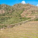
Ollantaytambo is considered a masterpiece of Inca architecture. The main section includes 17 imposing terraces leading up to a fortress. At the top there is an impressive 10-niche wall and Sun Gate, as well as a monolithic Sun Temple consisting of six enormous pink granite boulders.
The site also includes more terraces, colcas (storehouses), water fountains, and a water temple.
How to Visit Ollantaytambo Ruins
Don’t make the mistake of just passing through Ollantaytambo on the way to Machu Picchu like so many people do. These visitors often wish they had budgeted some days of their trip in Ollantaytambo when they see it.
My most recommended way is to spend a few days first in Pisac then in Ollantaytambo before you do the Inca Trail or go directly to Machu Picchu. Then visit Cusco, the largest, noisiest, and highest city in the area, at the end!
It is very easy to visit Ollantaytambo ruins on your own from town. This is specially compared to most other Inca ruins in the area, which are often in remote or mountain top locations that require taxi rides or long walks.
I highly recommend visiting the ruins as soon as they open in the morning (7 AM). When I did this, I had the entire archaeological site to myself for the first 45 minutes or so. This made my visit particularly special.
Many people visit Ollantaytambo as a part of a whirlwind Sacred Valley tour such as this one or this one. These tours are quite rushed and I don’t recommend them unless you are short on time and want to squeeze multiple major sites into a single day. These tours miss out on the small smaller ruins and things to do in Ollantaytambo town which I especially enjoyed.
While I don’t think a guide is necessary for visiting Ollantaytambo ruins, especially if you use my below self-guided tour, you can find guides at the ruins entrance if you want one. Their quality varies a lot.
Getting to Ollantaytambo Ruins
From Cusco, it is a 60-kilometer (37 mi), 1.5-hour drive to Ollantaytambo.
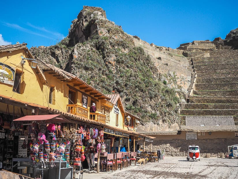
From the Plaza de Armas (main square) in Ollantaytambo, where most buses, taxis, and colectivos drop passengers off, it is only a five-minute walk to the ruins entrance. Follow Calle Principal west from the square. It goes down a small hill, across a bridge, past the Mercado Turistico, and then you are there.
It’s pretty much impossible not to find the way, as you can see the ruins from almost anywhere in town.
From the Ollantaytambo train station, it’s a longer walk, about 20 minutes, most of which is slightly uphill. You can also find a tuk-tuk there for about 5 soles.
Unlike other ruins (including Sacsayhuaman and Pisac ruins), you won’t be able to get into these ones for free by showing up super early. The entrance is gated and guarded from opening time at 7 AM.
Map of Ollantaytambo Ruins

The below map is posted just inside the entrance to Ollantaytambo ruins. As you can see, the map indicates the most complete circuit in red. However, the side trail to Inka Watana at the top was closed when I visited in 2023. The “medium” circuit in black skips the colcas (these don’t take much extra time, so don’t skip them!)
A “short” circuit in green only visit the bottom of the site, for those who aren’t able to climb up stairs. (Note: these circuits aren’t nearly as complicated as the new circuits and Machu Picchu!)
I found another pretty useful Ollantaytambo ruins map here. Finally, for AllTrails users, here’s the hiking trail through the ruins. This is pretty much exactly the route I followed through the ruins, and you won’t have too many other options.
Note that the side trail to Inka Watana (indicated as “Intihuatana” here), a small site higher up the mountain, was closed when I visited in 2023. The dotted lines (non-green line) and camera symbol are indicated on the AllTrails map, not in green.
Ollantaytambo Ruins Self-Guided Tour
Now I am going to walk you through the ruins as you will encounter them upon your visit. I will assume that you want to see as much of the site as possible.
Anyone is reasonable shape will be able to handle the tour. The hardest part, going up the terraces, will be right at the beginning.
Main Esplanade
After you pass through the entrance gate and get your Boleto Turistico stamped, you’ll find the site’s only restrooms to the left.
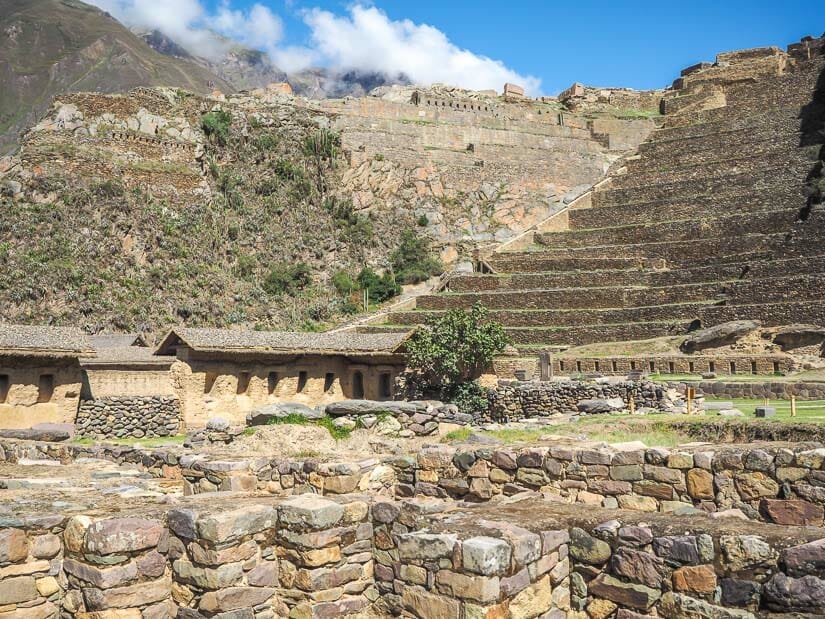
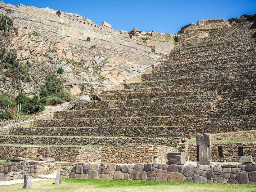
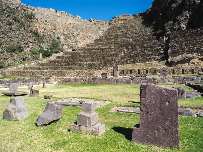
In front of you, it will be impossible to ignore the 17 immense terraces. But first, you’ll find a large grassy esplanade at the base of the terraces. There are several large carved boulders on display in the esplanade. They come in varying shapes and sizes, some with large numbers of angles, reminiscent of the famous 12-angled stone in Cusco.
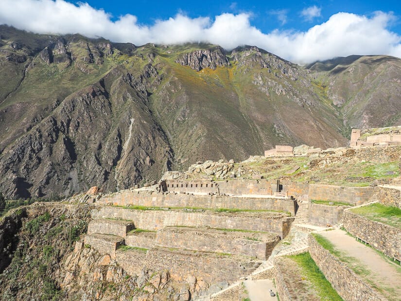
17 Terraces
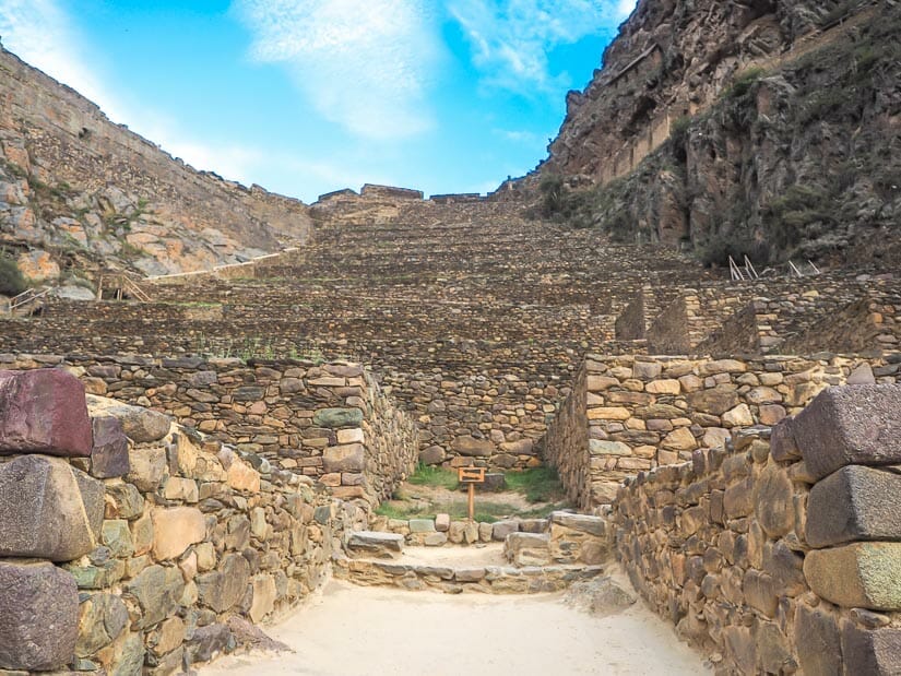
The main trail leads directly to the center of the imposing 17 stone terraces before you. It’s time to start climbing.
You’ll have the option to ascend stairs on either side of the terraces or right through the middle of the lower ones. Higher up, the terraces seem to get taller, with only the option to climb up the sides.
You can walk across most of the terraces, and some even have benches where you can sit and admire the view looking down on Ollantaytambo townsite.
Looking up and left, you’ll be able to see the Sun Gate, where you’ll be going next. Directly up is the control zone, while up and right you can see the path you’ll be taking at the end to connect to the other areas of the archaeological site.
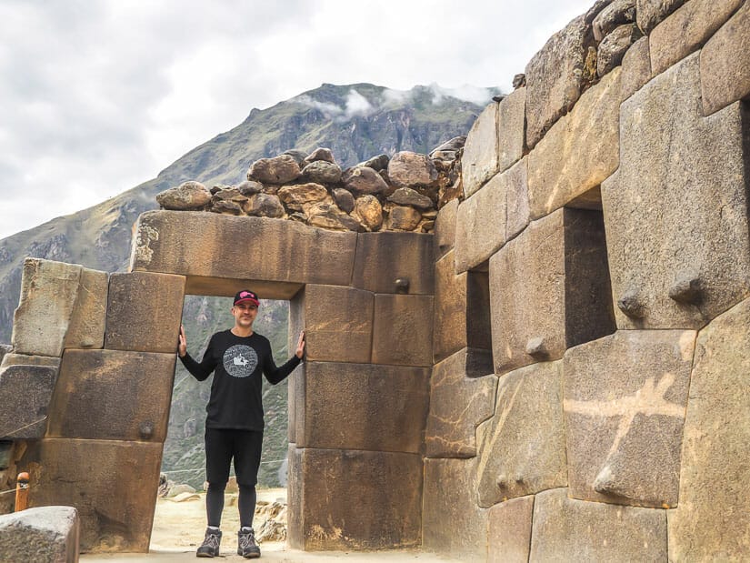
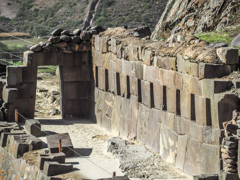
Wall of 10 Niches and Sun Gate
Just before reaching the highest terrace, a sign will point you to the left. The path veers up to a large stone platform. As you ascend a small staircase to the platform, you’ll note the exceptional stonework, orange spotting, and unusal bumps protrudinc from the back wall.
This back wall is called the Wall of 10 Niches (Diez Hornacinas). You’ll see the 10 niches as you walk towards the Sun Gate at the end.
The view looking to the Sun Gate at the end of the platform is probably the most famous and photographed spot at all of the Ollantaytambo ruins. Hopefully, if you’ve gone at the start of the day, you’ll have the platform all to yourself for some time, so you can fully appreciate its exceptional architecture, not to mention the great view looking down on the terraces.
Just before going through the gate, note the impressive corner stone to the left.
Pre-Inca Sector
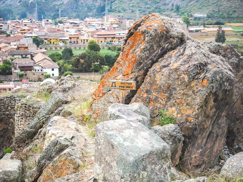
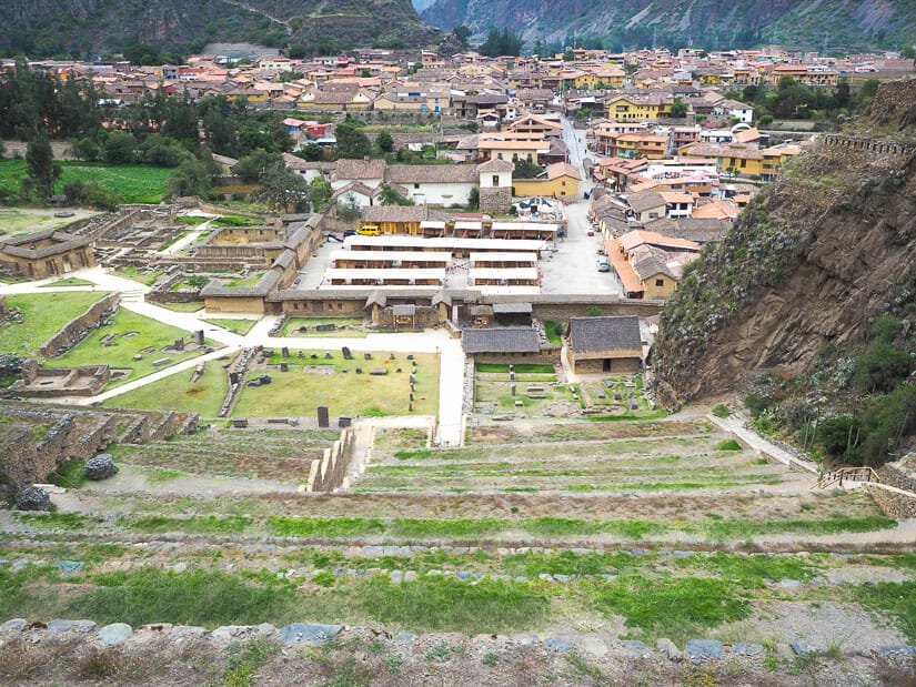
The view looking down on Ollantaytambo Archaeological Site is especially good just after you pass through the Sun Gate.
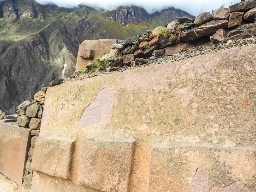
Then, straight ahead of you, you’ll see an area of large boulders and ruins at the top of the hill. It is labeled Sector Pre-Inka. These are the remains of a fortress that existed on site before Pachacuti razed much of it to build his own.
You can’t walk into this area. Instead, the path veers to the right from here.
Temple of the Sun
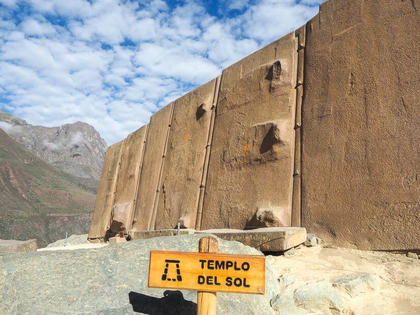
As you walk around the corner, a view will open up looking down on farmland behind the site. Note the scratches on a large boulder to the right as you round the corner.
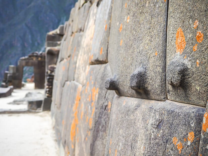
Next, you’ll walk between several large pink granite boulders, some with pointy ridges jutting out. This path brings you to one of the most impressive sights in the entire ruins: the Temple del Sol or Sun Temple.
The temple consists of six enormous pink granite monoliths standing up side-by-side, with molten bronze in their T joints. The largest of the stones measures two meters wide by four meters tall. It is difficult to imagine how the Incas moved and placed such immense slabs of stone.
Note the bumps sticking out from the surface of the stone, one of which looks like a puma.
To the temple’s right lies another boulder carved to look like seat or altar. Around the corner, three rectangular bumps stick out from the surface of more boulders.
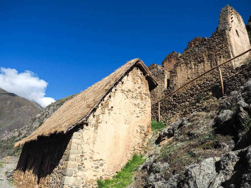
Control / Military Zone
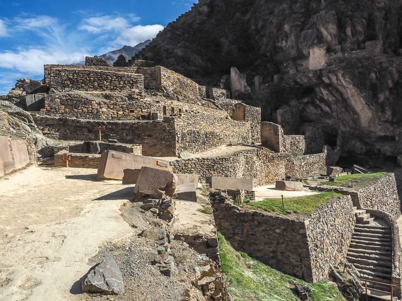
From here, the path connects to the Control Zone (Milatary Zone or Zona Militar). As the highest section of the main part of the ruins, the collection of buildings here would have served as lookout tours and for housing the guards or maybe even Inca himself.
There are a few different paths and routes through this area, but make sure you do at least explore it a little before taking the path along the top terrace to the colcas (see below).

At the back of the control zone, that is a side trail up the mountain to Inka Watana. This is a steep 20-minute trail to a small ruin further up the mountain, with an excellent view of Ollantaytambo. This trail was unfortunately closed when I visited in 2023.
Around 8 AM, when I was in the Control Zone, the sun finally rose above the mountains and started shining in on the whole site. I actually backtracked at this point to get some better pictures, now that the Sun Temple and other parts of the ruins were illuminated by the sun. Note that you aren’t supposed to backtrack when it’s busy, but I was still alone at this point.
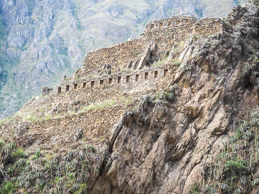
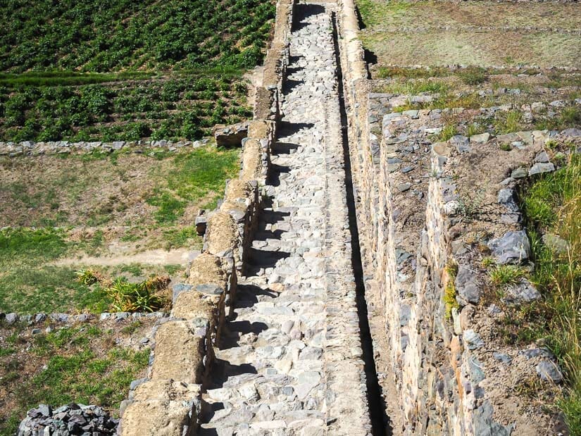
Trail to the Colcas

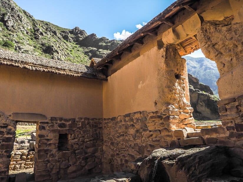
After visiting the Control Zone, follow the trail along the top terrace. A small stone staircase with stone railing leads into a watchtower built into the side of the cliff. This section is called Balconpata.
The watchtower wall consisted of three windows, each with two niches between them. These windows offered epic views of the main terraces, Sun Gate platform, and mountains behind the site.
The path then goes around the corner of the cliff then crosses the top of another large set of terraces. At the end of that set, you have the option to go down the stairs to the bottom of the site, or cross a third set of terraces to the colcas (storehouses).
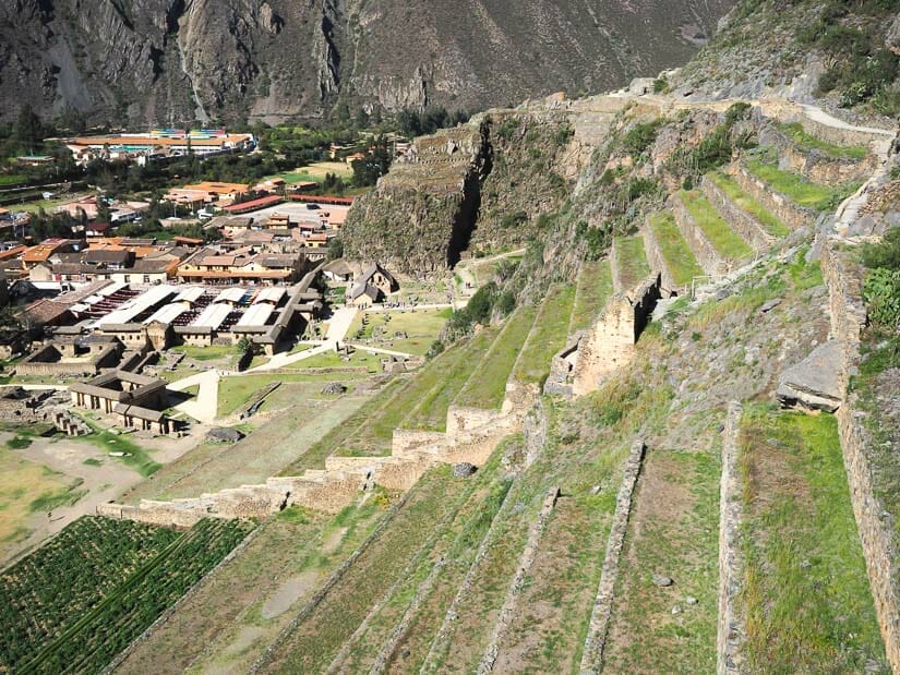
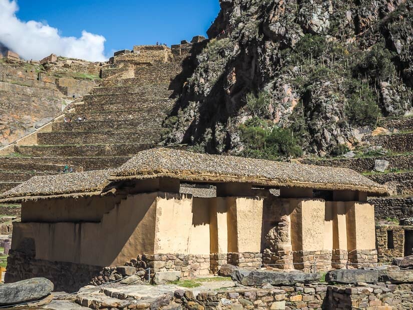
Definitely go straight to check out the colcas before going down. There are two large colcas here, similar to the ones at Pinkuylluna (the ruins at the opposite end of town, and visible from where you now stand).
The path crosses between the two colcas, the returns below the lower one, which you can actually enter.
Returning to the staircase, follow it steeply downhill between the two sets of terraces to the bottom of the archaeological site. The view looking down on the ceremonial fountains area as you descend is excellent.
Also note that some of these terraces here are still being used by farmers today!
Inka Misana

At the bottom of the stairs, you’ll see a sign pointing left to Inka Misana and right to Fuente Ceremonial (Ceremonial Fountain). Go left to Inka Misana first.
Right away you’ll find yourself in an area of water fountains, with the soothing sound of flowing water. Then you’ll reach the site of Inka Misana, where there are several niches, false doorways, and caves carved into the sides of the cliff. Inca stone walls and foundations lie at the base of the cliff.
This was an area of aqueducts leading into the site, using water from the Patacancha River. It may also have had ceremonial purposes. It is a pleasant and calming area to stroll through.
Once you can’t go any further (you’ll see yet another small collection of terraces that you can’t get to), turn back and follow the path towards the water area and ruins entrance. As you cross the large field called Kuychipunku or Plaza Mañay Rakay (Square of Petitions), watch for the two round piles of stones, whose purpose is unknown.
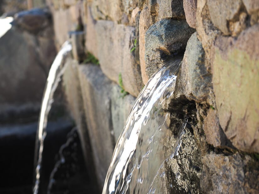
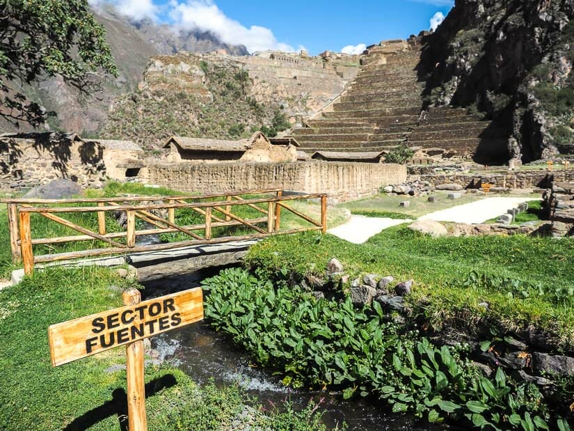
Water Temple and Ceremonial Fountains
There are a few different ways you could tackle this area, but I chose to visit the Water Temple (Templo de Agua) first. The temple has an Inca stone base with reconstructed walls with thatched tops (this temple had to no roof).
You’ll see the back of the temple first, through which water flows into the temple. You’ll need to go around to the front to enter the temple. Water still flows into the temple today, falling off a rocky ledge into a pool before disappearing below.
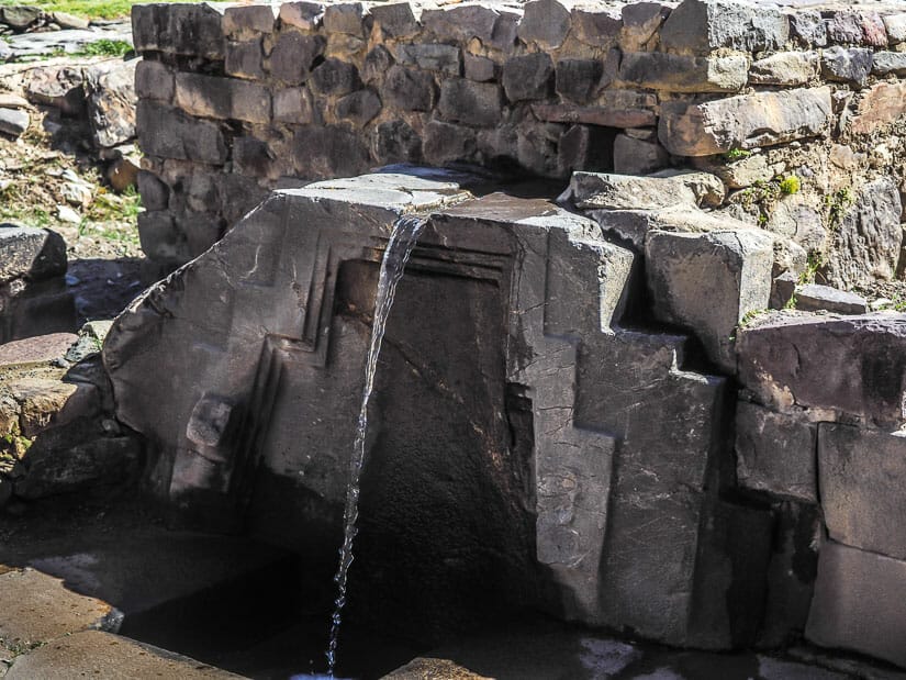
Outside and adjacent to the Water Temple, there is a large area of Ceremonial Fountains, with several different walking paths through them. The most interesting, the Fuente Ceremonial, right is right next to the Temple of Water.
Viewed from above, you can see two canals carved into the stone, which guides the water to two different fountains below.

Continue through this area to the back (city) side, where you’ll cross a small stone bridge over the stream (Patacancha River) to find another cute little water fountain. Just past it, in the direction of the main site entrance, don’t miss the Ñusta’s Bath (Princess Bath or Baño de la Ñusta), an especially perfect fountain.
After that, a wooden bridge will take you back toward the esplanade at the base of the main terraces and exit of the site. The view looking up at the main terraces and ruins of Ollantaytambo from around the wooden bridge is phenomenal.
Speaking of bridges, don’t miss my guide to hiking to the incredible Inca Bridge at Machu Picchu!
That brings us to the end of our Ollantaytambo ruins tour. I hope you like these ruins as much as I did! Make sure to also check out my other recommended things to do in Ollantayambo, plus more ruins I loved in the general Cusco area!