Dear reader: This article contains links to products and services that I may be compensated for, at no extra cost to you.
Canmore is my favorite town in all of Alberta. From its dramatic Rocky Mountain setting to laid-back, environmentally-friendly vibe, the town is a paradise for lovers of the great outdoors. Without a doubt, one of the best things to do in Canmore, and the perfect way to experience this area, is through hiking.
Because I usually visit my kids, we’ve become quite familiar with the many easy walking trails in Canmore. The town literally is crisscrossed with them; you could traverse town from north to south or east to west without leaving a trail.
Meanwhile, even more easy Canmore hikes spread out from town in surrounding Kananaskis country. Some follow the banks of the Bow River, while others meander up creeks or stunning alpine lakes at the base of the numerous iconic peaks flanking Canmore.
In this article I’ve compiled 20 of the best short and easy hikes in Canmore. I’ve labeled them extremely easy (wheelchair or stroller accessible), very easy (mostly flat but not accessible), easy (some gentle up and down and a little longer) and easy – moderate (some steepers parts and longer than 1 or 2 hours). The walking times I list are for slow walkers, such as those hiking in Canmore with kids.
I’ve also included a section of hikes near Canmore, which I’ve limited to 30 minutes or less driving time from town. For more ideas a little further away, see my similar guide to the best short and easy hikes in Kananaskis.
Table of Contents
Easy Hikes in Canmore Town
The following 12 easy and mostly short Canmore hikes are locally within the limits of Canmore town. We begin right at the centre of town then spread outward.
Because all of the trails in this section are technically in Canmore town and not Kananaskis, you don’t need to get a Kananaskis Conservation Pass to access any of them. Parts of hikes #4 and #10 do cross into Kananaskis area, but I can’t imagine there would be conservation officers waiting in the bushes to check passes (the passes are actually registered online with your license plate number; there’s no physical pass).
When staying in Canmore town, I recommend the low-cost and family-friendly Rocky Mountain Ski Lodge (see on Booking / TripAdvisor / Agoda) or for a luxurious stay, Malcolm Hotel (see on Booking / TripAdvisor / Agoda).
1. Policeman Creek Trail
Distance: 4.2 km out-and-back
Walking time: 1.5 hrs or less
Difficulty: Extremely easy
Paved/Accessible: Partially
Policeman’s Creek Boardwalk is perhaps the most well-known walking trail in Canmore town. Much of it is a boardwalk that follows Policeman Creek through town. Despite being right in town, the trail features surprisingly gorgeous scenery and mountain views, no matter the time of year.
While this trail is 4.2 kilometers if you do the whole thing from south to north and back, there are actually several points in town where you can access it. Thus you can just walk one shorter section of the trail, making this trail as short and easy as you want it to be.
The most convenient place to access the trail is from the Big Head Sculpture on 8th street, just east of downtown Canmore. From there, you can follow the trail north or south.
While the boardwalk is totally flat and suitable for strollers or wheelchairs, there are a few spots with steps.
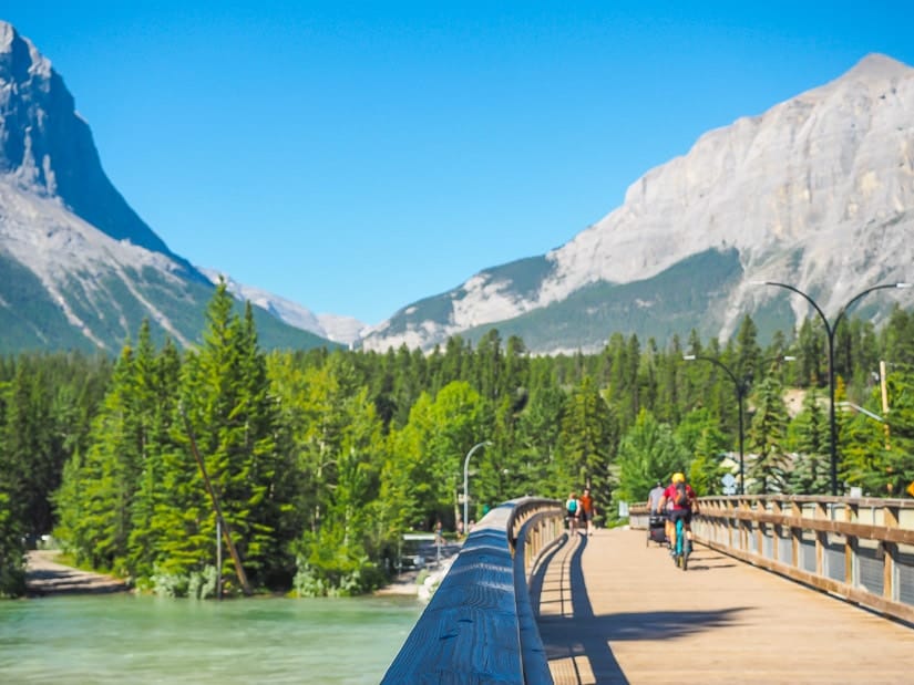
2. Spur Line Trail
Distance: 3.0 km out-and-back
Walking time: 1 hr or less
Difficulty: Extremely easy
Paved/Accessible: Yes

Spur Line is another super easy trail that crosses Canmore town, but from east to west. In the east, it crosses paths with the northern end of Policeman’s Creek Trail. From there, the forested trail heads west to the beautiful Canmore Engine Bridge.
This spot is especially beautiful in the early morning, when the lighting is perfect on the mountains backing the bridge. For a shorter walk, you can stop there. To do the full walk, cross the bridge and follow the trail west and then south.
Once you reach a small branch of the Bow River, technically the end of the Spur Line Trail, can either backtrack to where you started, or do a loop back to downtown via Bow River Bridge, part of the Bow River Loop Trail (see next entry below). While there is no entry for just the Spur Line on AllTrails, the trail route is marked on GoogleMaps.
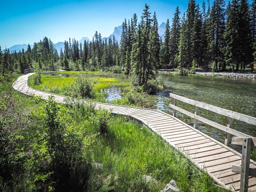
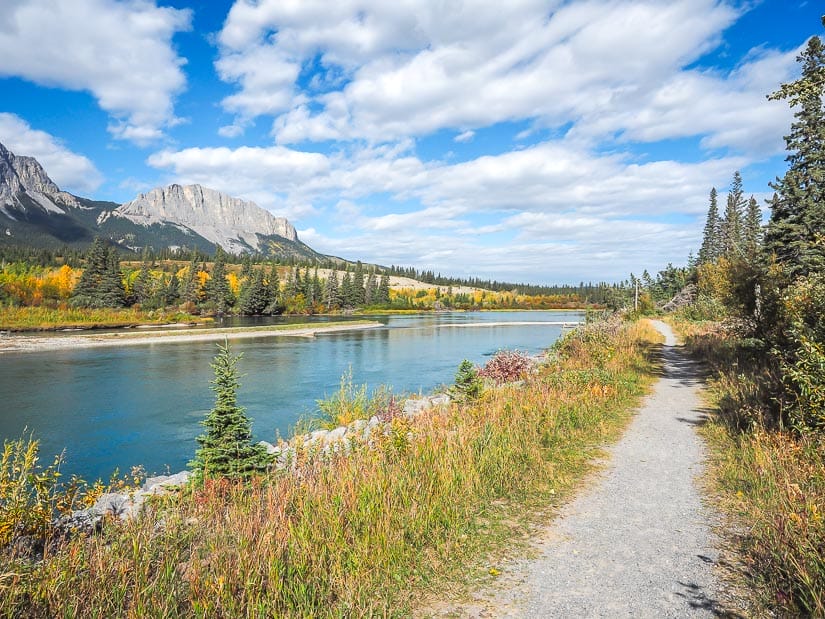
3. Bow River Loop Trail
Distance: 2.1 km loop
Walking time: 30 min – 1 hr
Difficulty: Extremely easy
Paved/Accessible: Yes
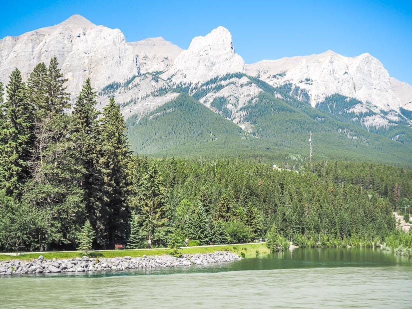
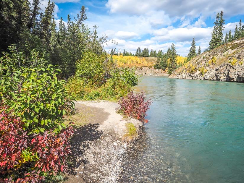
Bow River Loop is a paved and extremely easy walking trail that begins at Bow River Bridge right next to downtown Canmore. From there, the trail crosses the bridge and heads north along the bank of the Bow River (trail pictured above).
Next, the trail connects to the Spur Line Trail (see previous entry) and crosses the Canmore Engine Bridge back toward toward. Instead of following the Spur Line east into town, the Bow River Loop instead follows the eastern bank of the Bow River south back toward the trail started.
This hike is totally paved and flat, it’s one of the best wheelchair and stroller-friendly hikes in Canmore. It’s also suitable for cycling, rollerblading, and so on.
4. Larch Island Trail
Distance: 3.5 km loop
Walking time: 1 hour
Difficulty: Very easy
Paved/Accessible: Partially
Larch Island Walking Trail is yet another super easy hike in Canmore. Because it is so easy and passes right by a playground, I think this is one of the best easy Canmore hikes for kids.
This loop trail can be accessed from a few different spots in the residential area just north of downtown Canmore, including the ends of 16 street or 1100 Larch Pl. There are spaces to park at each of those spots.
From there, the trail goes through a marshy area on Larch Island, which is formed by branches of the Bow River. Although the trail stays east of the main branch of Bow River, it technically leaves Canmore town and enters Canmore Nordic Centre Provincial Park.
After meeting the main section of Bow River, the trail veers northeast back toward the residential neighborhood, where it passes right by Larch Park playground. There’s no AllTrails page for this walk, but it’s clearly denoted on GoogleMaps.
Got kids? Also see my guides to visiting Banff with kids, Jasper with kids, and Edmonton with kids.
5. Bow River Trail
Distance: 6.1 km out-and-back
Walking time: 2 hrs
Difficulty: Easy
Paved/Accessible: Partially
Not to be confused with Bow River Loop (#3 above) or the identically named Bow River Trail in Bow Valley Provincial Park (#20 below), this Bow River Trail also begins from Bow River Bridge next to downtown Canmore.
Instead of crossing the bridge, this trail follows the Bow River riverside path south, which is paved and wheelchair/stroller friendly. After a while, the trail heads inland on a gravel/dirt path; all season strollers should still be manageable here.
The trail then meets the Bow River again, and finally terminates at Three Sisters Viewpoint, an excellent view of the iconic mountain peaks, with the Bow River in the foreground. For a much shorter and easier trail to the same viewpoint, see the next entry.
6. Three Sisters Viewpoint Trail
Distance: 0.8 km out-and-back
Walking time: 20 min
Difficulty: Very easy
Paved/Accessible: No
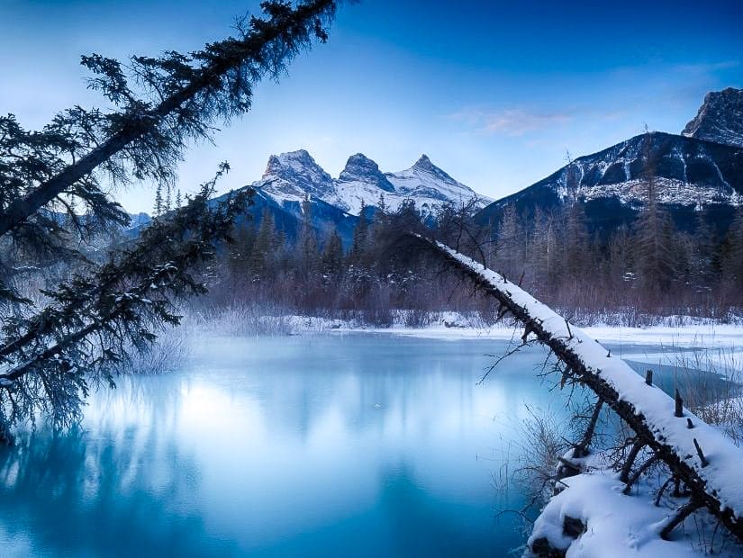
This super short Canmore hike is a much easier option for reaching Three Sisters Viewpoint than the previous entry.
From the parking lot, an easy dirt trail follows Cougar Creek to the point where it meets Policeman Creek. There, you’ll enjoy a marvelous view of the iconic triple peak, reflecting in the water if you’re lucky enough!
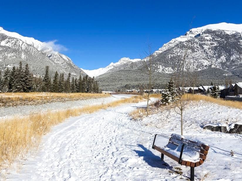
Visiting the mountains in winter? See my guides to Banff in winter and Jasper in winter.
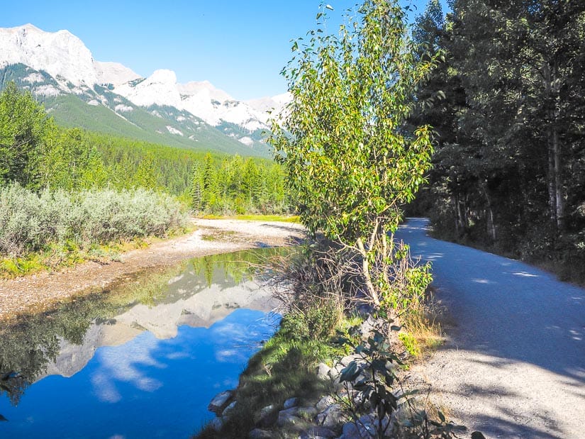
7. West Canmore Park to Three Sisters Pathway
Distance: 13.5 km out-and-back
Walking time: 3 hrs
Difficulty: Easy – Moderate
Paved/Accessible: Partially
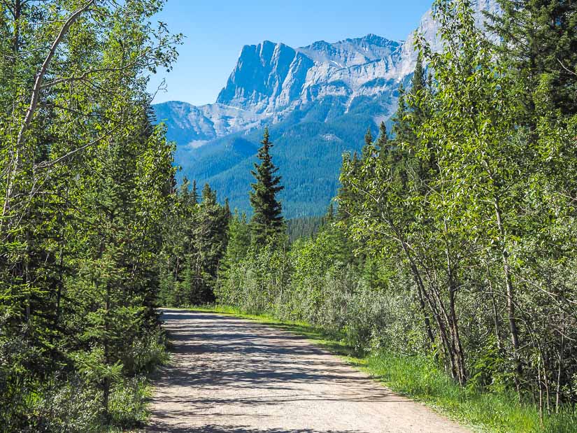
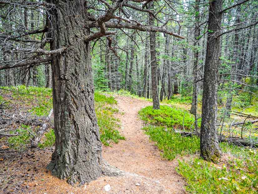
The easy but longer West Canmore Park to Three Sisters Pathway hike begins in West Canmore Park, which can accessed by crossing the Bow River Bridge from downtown.
The trail begins flat and wide, as in the above photo, then slowly makes its way uphill toward the Three Sisters Community, a suburb of Canmore south of town. There are lots of Bow River views along the way. This trail does have more up and down than all the other trails covered so far on this list. Some sections of it are paved, and many people cycle along this trail.
If you’re able to have someone pick you up or drop you off at one end, then you can cut this trail’s walking time in half. Another way to make it even easier is to start at the Three Sisters Community end and walk back to Canmore; that way you’ll be walking downhill most of the way.
8. Canmore Creek Trail
Distance: 3.2 km out-and-back
Walking time: 45 min – 1 hr
Difficulty: Easy
Paved/Accessible: Partially
Canmore Creek Trail is yet another easy trail that starts at Bow River Bridge. This trail is convenient because you can follow it reach Quarry Lake from Canmore town rather than walking there. This is especially useful now that Quarry Lake has a parking fee for non-Canmore residents (see next entry for details).
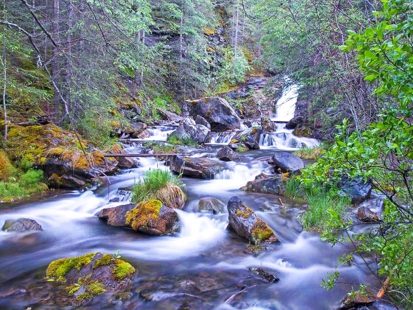
The trail begins by following the Bow River, then heads uphill along lovely Canmore Creek, including a few small waterfalls. In total, you’ll gain about 100 meters in altitude, and while this one is still easy, it’s not suitable for bikes. At the top of the trail, simply cross Highway 742 to reach Quarry Lake’s parking lot.
9. Quarry Lake Loop
Distance: 1.1 km loop
Walking time: 15 – 30 min
Difficulty: Very easy
Paved/Accessible: No
Quarry Lake is an extremely popular spot in Canmore for swimming, walking, and picnics. The mountain scenery around the lake is gorgeous, especially in the early morning or evening. It is technically the only lake in Canmore town.
Due to overcrowding issues, the city is now charging $10 to park for there for two hours in peak season, and $2.50/hr in non-peak season. If you decide to visit, try to come at non-peak hours, and to avoid the parking fee, you can walk there from town (see previous entry).
From the parking lot, a Quarry Lake Trail leads to the small lake, then does a full loop around it. The dirt trail is totally flat, so parents with decent strollers should be fine on it. Note that dogs are not allowed around the lake, but they are allowed at the popular dog park next to it.
If you love stunning lakes, also see my guide to the best easy-to-reach lakes in Banff and easy-to-reach lakes in Jasper!
10. Three Sisters Creek Trail
Distance: 3.4 km out-and-back
Walking time: 1.5 hrs
Difficulty: Easy – Moderate
Paved/Accessible: No
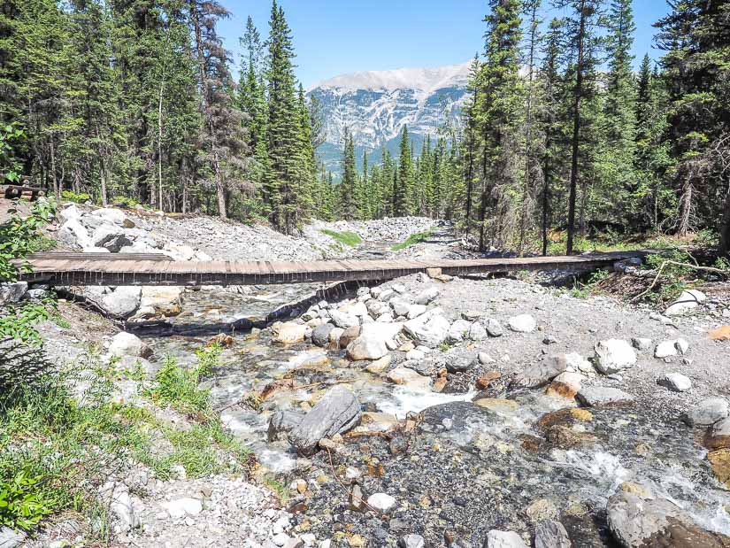
Three Sisters Creek Trail is an off-the-beaten-track trail that begins in Three Sisters Community. Thus it could be an add-on to the West Canmore Park to Three Sisters Pathway (#7 above), or you can just drive to the trailhead.
This easy trail follows the Three Sisters Creek gently uphill at the base of the mountain of the same name. In total you’ll gain just under 200 meters, making this trail easy – moderate. It’s still totally suitable for kids, and it tends to be totally free of crowds, even on weekends.
There are a few parking spaces along the street at the trailhead. Note that Three Sisters Community is technically part of Canmore, but the upper half of the trail does cross into Kananaskis. I highly doubt there will be a conservation officer waiting up the woods to check passes though, so I personally didn’t bother getting a Kananaskis Conservation Pass just to do this hike.
11. Canmore Hoodoos Trail & Loop
Distance: 1.0 km out-and-back to hoodoos
Walking time: 20 min (or longer if you do the whole trail)
Difficulty: Easy – Moderate
Paved/Accessible: No
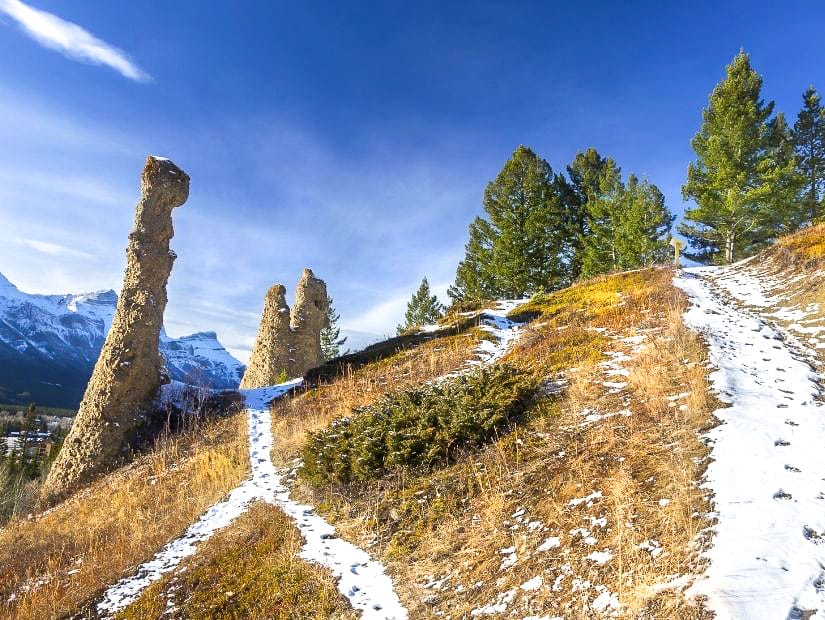
Hoodoos, which are normally associated with badlands areas like Drumheller, can also be found in Canmore and Banff.
The Canmore Hoodoos are easy to reach from the section of Canmore east of the Trans-Canada Highway, but unfortunately the AllTrails maps for the Canmore Hoodoos Trail and Canmore Hoodoos Loop are not good.
You can actually reach the hoodoos in only 5 – 10 minutes from the trailhead of either hike. Just after you pass the graveyard on the left, you’ll need to turn right onto a trail that goes uphill to reach the hoodoos. If you aren’t watching for the hoodoos, it’s easy to miss the turnoff.
Those who do the full hike on either trail complain that both are not signed well and it’s easy to get lost. Many people even end up on the golf course nearby. Therefore, I recommend just going to the hoodoos and back. Even though it’s really short, I rate this trail as easy – moderate because it’s not easy to find the way, and there’s a bit of a scramble just before the hoodoos.
12. Cougar Creek Trail
Distance: 9.5 km or less out-and-back
Walking time: 3 hrs or less
Difficulty: Easy – Moderate
Paved/Accessible: No
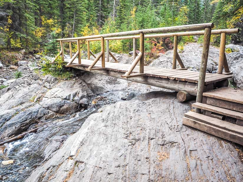
Another hike that can easily be accessed from the eastern section of Canmore is Cougar Creek Trail. The trail follows Cougar Creek up a valley between Grotto Mountain and Mt. Lady McDonald, with lots of evidence of the 2013 flood. Please note that as of July 2021, this trail is indefinitely closed for repairs.
At some points the trail all but disappears, but you just keep following the creek. As an out-and-back, the trail can be as short or as long as you’d like. Some people don’t go far at all, and just bring their kids to play in the stream.
The further uphill you go, the better the scenery gets. However, the trail is mostly a stream bed of loose rock, so it involves lots of hopping between stones and sometimes crossing the creek on logs. Therefore, it’s best to bring poles for stability and watch your step carefully to avoid ankle injuries.
Easy Hikes Near Canmore
The remaining 8 entries are short and easy hikes around Canmore. I’ve set a limit of 30 minutes or less from Canmore town by car. All except the first are found along the Trans-Canada Highway (Highway 1) and Bow Valley Trail (Highway 1A) east of Canmore. For more hiking trails further away from Canmore and deeper into Kananaskis country, see my guide to the best easy hikes in Kananaskis.
Because all of the following trails are in Kananaskis country, you need to register your license plate for a Kananaskis Conservation Pass ($15/day or $90 per year) online to stop at any of them.
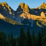
13. Grassi Lakes Trail
Distance: 4.3 km loop or out-and-back
Walking time: 2 hrs
Difficulty: Easy – Moderate
Paved/Accessible: No
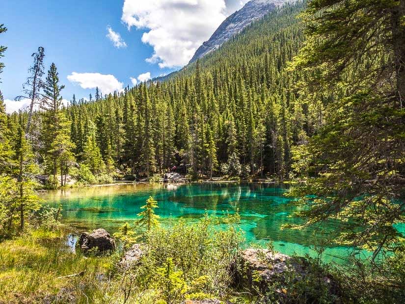
Grassi Lakes is one of the most popular easy hikes in Canmore and the most beautiful lakes near Canmore. The two alpine lakes at the end of the trail are stunningly gorgeous and vibrantly colored, adding weight to the argument that Alberta is Canada’s most beautiful province.
The trail and lakes are just west of Canmore town, but technically located in Kananaskis country as they are a part of Canmore Nordic Centre Provincial Park.
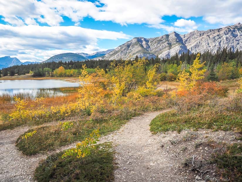
The trail to Grassi Lakes has the option of an easier lower trail and a slightly more difficult upper trail. For the easiest walk, just take the lower trail there and back (the first map above recommends taking the upper trail there and lower one back. Good strollers are manageable on the lower trail.
Because Grassi Lakes is incredible popular, it’s best to avoid peak times.
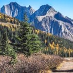
14. Grotto Canyon Trail
Distance: 7.1 km out-and-back
Walking time: 2.5 – 3 hours
Difficulty: Easy – Moderate
Paved/Accessible: No
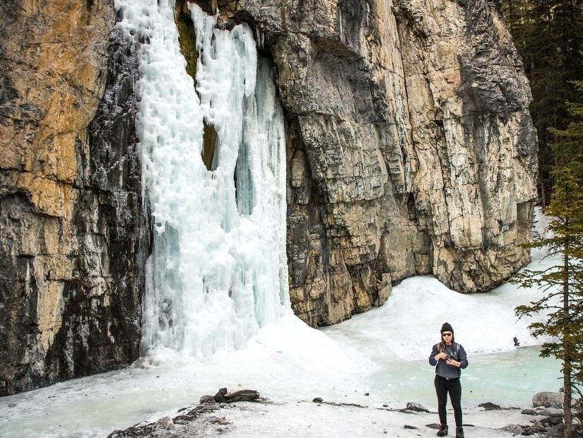
Along with Grassi Lakes, Grotto Canyon Trail is one of the most popular easy hikes in the Canmore area. The trail follows a creek bed up a rocky valley, with the chance to see pictographs on the cliff walls, a waterfall, an inukshuk Garden, and Grotto Canyon Cave.
This trail is one of the longer and more difficult ones on this list, but it is still very popular among families, and kids seem to really enjoy the challenge.
The trail is also popular in winter, when you can walk on the frozen creek and see frozen waterfalls. However, in winter the trail is more difficult because it can be very slipper, and ice cleats are strongly recommended. You’ll also want to make sure the ice is thick enough before you consider walking on it. For all you waterfall chasers, make sure to see my guide to the best Alberta waterfalls!
Because this trail is so popular in all seasons, it’s best to come at off-peak times. The trailhead is on Bow Valley Trail (Highway 1A) 10 minutes east of Canmore.
15. Heart Creek Trail & Bunker
Distance: 4.8 / 4.0 km out-and-back
Walking time: 1 – 1.5 hrs each
Difficulty: Easy
Paved/Accessible: No
From a parking lot right off the Trans-Canada Highway, there are two easy trails that make for a convenient stop just before reaching Canmore: Heart Creek Trail and Heart Creek Bunker.
Heart Creek Trail is the nicer trail of the two. For the first section, you’ll hear traffic from the Highway, but once you reach the creek and follow it upstream, it becomes a pleasant, relaxing stroll.
Heart Creek Bunker runs parallel to the highway for most of the way, so the trail itself is less enticing, but at the end you get to enter a 55-meter deep bunker from the Cold War era, which is very cool. Bring a flashlight to see better inside!
16. Flowing Water Trail
Distance: 2.3 km loop
Walking time: 30 min – 1 hr
Difficulty: Very easy
Paved/Accessible: No
Inside Willow Rock Campground in Bow Valley Provincial Park, the lovely Flowing Water Trail is an easy stroll along Kananaskis River and then through a beaver-inhabited marshland.
It’s a very easy trail with only one short uphill bit. One minor annoyance is that you have to walk through half the campground to get to the trailhead; if you come in the off season when most of the campsites are empty, you can just park in one of the sites near the trail. The trailhead is between sites 86 and 87 on the Lower Loop.
17. Montane Trail
Distance: 1.4 km loop
Walking time: 30 min – 1 hr
Difficulty: Very easy
Paved/Accessible: No
The last 4 trails on this list are all located in the main section of Bow Valley Provincial Park, between Highway 1 and Bow River. It is also the location of Bow Valley Campground.
Of the 4 trails, Montane Trail would be my last pick, but I still include it because it is a short, easy, and usually uncrowded trail. This trail begins from the Bow Valley Administration & Information Centre, which is just inside the area when you turn in off Highway 1X (a short highway that connects Highway 1 and 1A).
The loop trail crosses and meadow then a section of typical montane alpine forest.
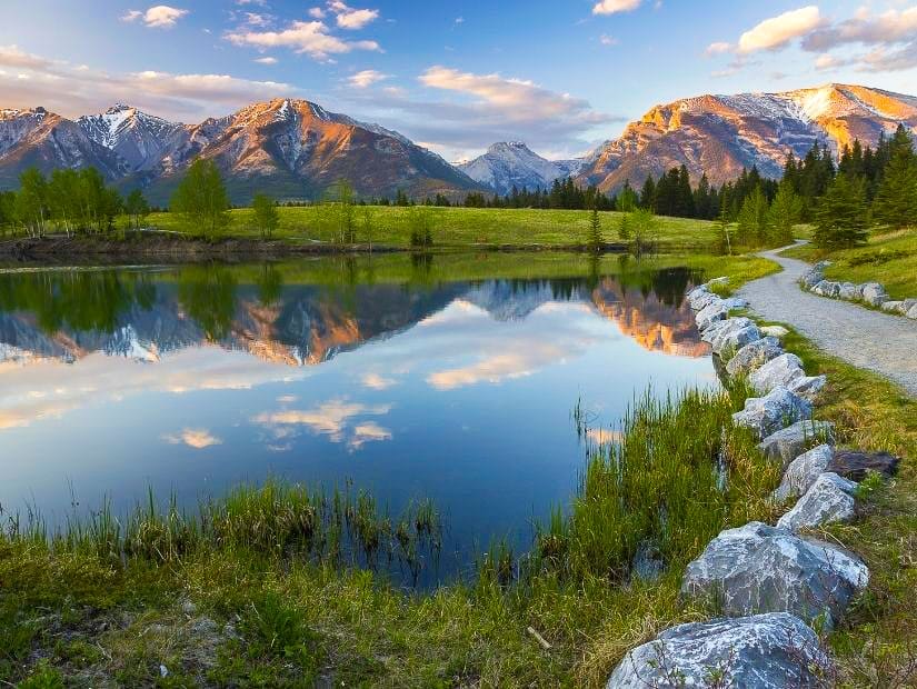
18. Middle Lake Trail
Distance: 2.3 km loop
Walking time: 45 min – 1 hr
Difficulty: Easy
Paved/Accessible: No
A few minutes further down the road, Middle Lake Trail is loop trail that begins at the shore of a lovely lake. To be honest, you don’t have to walk the whole loop to enjoy the best part, which is the incredible view of the lake at the start of the trail.
The lake view is only a few minutes from the parking lot. If you do decide to press on, the easy loop trail doesn’t go around the lake, but rather through the forest beside the lake.
19. Many Springs Trail
Distance: 1.6 km loop
Walking time: 30 min – 1 hr
Difficulty: Very easy
Paved/Accessible: No
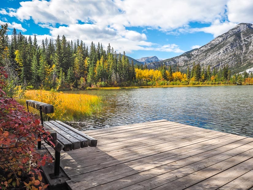
A few minutes more down the road will bring you to Many Springs Trail, yet another easy loop trail, but this one actually goes around the lake. This one is very easy as well, and if you wish you can make it even easier and shorter by only going a quarter way around the lake in either direction.
If you go a quarter way around clockwise, you’ll reach the lovely dock in the above photo. A quarter way in the other direction will bring you to a boardwalk bridge over a creek from the lake.
20. Bow River Trail
Distance: 3.7 km out-and-back
Walking time: 1 hr or less
Difficulty: Very easy
Paved/Accessible: No
Not to be confused with the Bow River Trail in Canmore (#5 above), this Bow River Trail is the final easy hike in Bow Valley Provincial Park and on this list.
Probably my favorite of the four, this one begins at Whitefish Day Use Area (a gorgeous spot for a picnic), and then follows the Bow River downstream. The best part is the views of the river and towering peaks on the other side that will accompany you the whole way.
The hike is a little less private, though, as you will be passing right along the back of several campsites in Bow Valley campground, which back onto the river.
Thank you if you’ve read this far, and I hope that you’ve found plenty of ideas for easy and short hikes in Canmore and the surrounding area. If I’ve missed anything that you feel should be included, please feel free to comment below!