Dear reader: This article contains links to products and services that I may be compensated for, at no extra cost to you.
Kananaskis country is a large section of the Alberta Rocky Mountains and their foothills that lies south of Jasper and Banff National Parks. The area encompasses around a dozen provincial, wildland, and ecological parks, with the town of Canmore being the main access point at its northern end.
The best way to get to know Kananaskis is through its wealth of hiking trails and stunning lakes. Because I usually go hiking with my kids when we make the trip down from Edmonton, I’ve decided to compile our favorite easy hikes in Kananaskis.
Canmore is not technically part of Kananaskis, but the town also has many easy walking trails of its own. Therefore, I’ve written this whole other post covering the best easy hikes in Canmore. For even more ideas besides hiking, here are 40 fun things to do in Kananaskis.
When checking other lists of the best easy Kananaskis trails, I’ve found that most include hikes that are moderate or even hard (i.e. written by people who don’t have kids), while some of the best short Kananaskis hikes are missing.
So in this article, I’m really sticking to the easiest and best Kananaskis trails for kids, the elderly, or anyone looking for the most scenic yet very easy walks in Kananaskis.
I’ve rated each of the following trails as extremely easy (wheelchair & stroller accessible), very easy (mostly flat but not accessible), easy (1-2 hours with some mild up and down) or easy – moderate (2 hours+ with some steeper parts). The times I list are for slow walkers. I hope this helps you find the perfect Kananaskis hike for your needs!
Table of Contents
Best Easy Hiking Trails in Kananaskis: Summary
Most popular: Grassi Lakes (#3), Grotto Canyon (#5), Troll Falls (#14)
Accessible/Stroller-friendly: Bow River Loop Trail (#1), Mt. Lorette Ponds (#13), Rockwall Lake (#19)
Personal Favorites: Larch Islands Interpretive Trail (#2), Ptarmigan Cirque (#18), Blackshale Suspension Bridge (#21)
Where to Stay when Hiking in Kananaskis
If you plan to go hiking mainly around the town of Canmore, then it makes sense to stay in Canmore town, with its full range of accomodations and other amenities.
For budget travelers or visitors with kids, I recommend Rocky Mountain Ski Lodge (see on Booking / TripAdvisor / Agoda). For a more luxurious stay, try the award-winning Malcolm Hotel (see on Booking / TripAdvisor / Agoda).
For basing yourself near the many hikes further south in Kananaskis, there are only a few options: Kananaskis Mountain Lodge (see on Booking / TripAdvisor / Agoda) or Crosswaters Resort (see on Booking / TripAdvisor / Agoda) in Kananaskis Village, HI Kananaskis Wilderness Hostel (see on Booking / TripAdvisor / Agoda), or the remote but pristine Engadine Lodge (see on Booking / TripAdvisor / Agoda).
Easy Hikes in Canmore Nordic Centre Provincial Park
Canmore Nordic Centre Provincial Park is a very small (4.5 km2) provincial park immediately west of Canmore town. Essentially, as soon as you cross the Bow River from Canmore town, you are in it, with some exceptions.
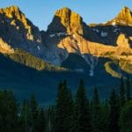
Besides the Nordic Centre itself, which is famous for having hosted several winter events in the 1988 Winter Olympic Games, the park features gorgeous scenery with ever-present views of towering Rundle Mountain, Ha Ling Peak on Mt. Lawrence Grassi, and the Three Sisters.
The following are four easy hiking trails in the park that are easily accessible from Canmore town, either on foot or by short drive.
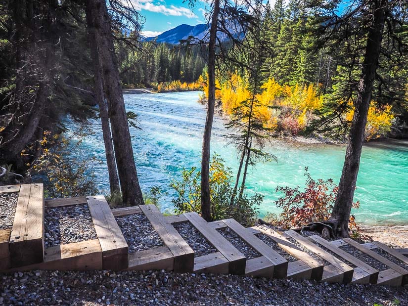
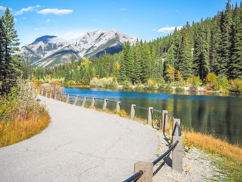
1. Bow River Loop Trail
Distance: 2.1 km loop
Walking time: 30 min – 1 hour
Difficulty: Extremely easy
Paved/Accessible: Yes
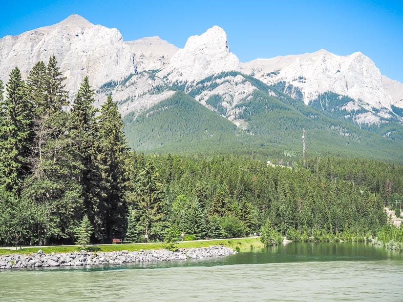
The Bow River Loop Trail is one of the easiest walking trails in Kananaskis. The paved trail begins by following the Bow River south through Riverside Park right next to downtown Canmore.
The path then crosses Bridge Road, the main vehicle road across the Bow River, into Canmore Nordic Centre Provincial Park. It then veers north and follows Spur Line Trail along the west bank of a branch of the Bow River.
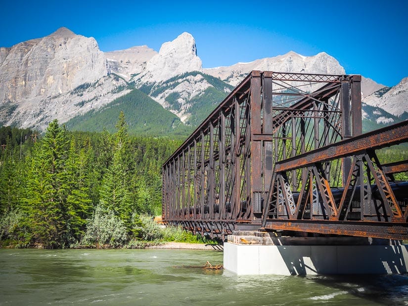
Eventually the trail crosses back over the river toward town on the historic, pedestrian-only Canmore Engine Bridge. The views here are particularly lovely in the morning, when the sun lights up the bridge and mountain peaks behind it.
Because it is accessible from town, mostly paved, yet offers such gorgeous scenery, this is one of the best wheelchair or stroller-friendly Kananaskis hikes.
This trail can also be combined with the next one for a longer stroll.
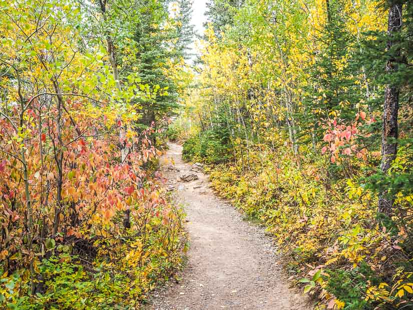
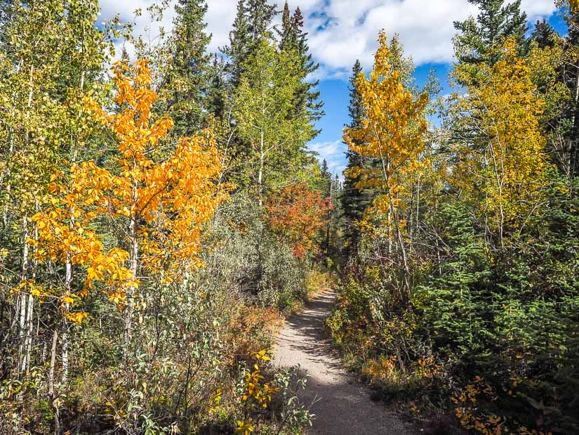
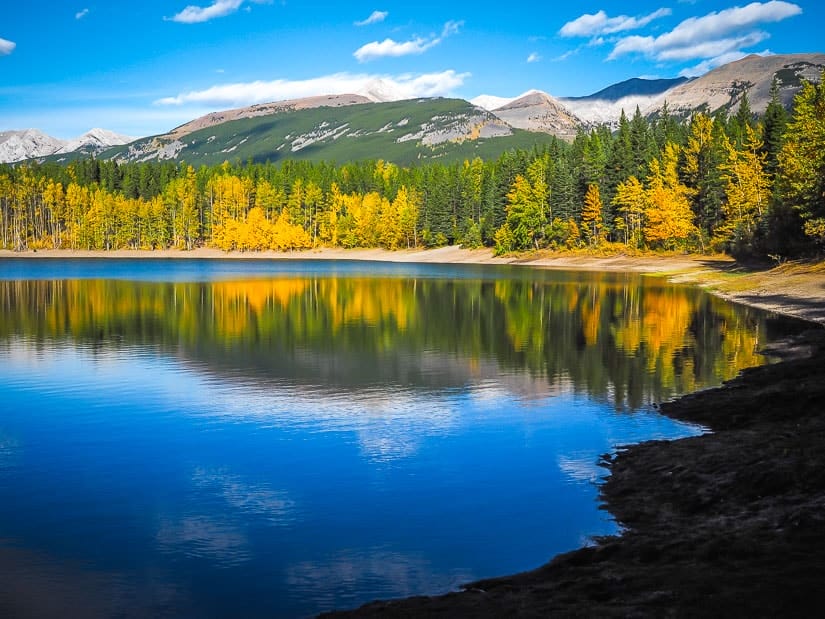
2. Larch Islands Interpretive Trail
Distance: 3.5 km loop
Walking time: 1 hour
Difficulty: Very easy
Paved/Accessible: Partially
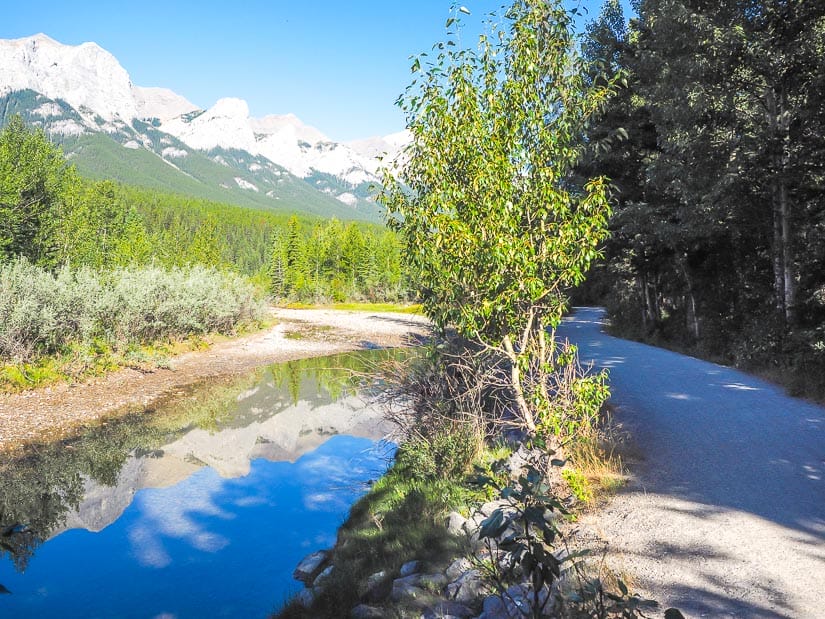
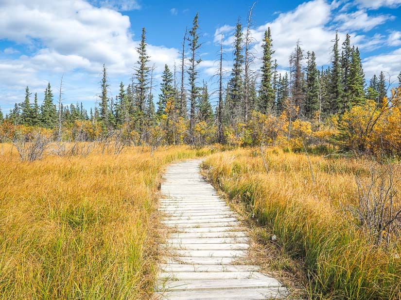
Further upstream, Larch Island Walking Path is another very easy Kananaskis walking trail that begins in Canmore town but crosses into Canmore Nordic Centre Provincial Park. It is one of the best Kananaskis hikes for kids.
The trail can be accessed from various points in the residential area just north of downtown Canmore, such as at the end of 16 st or 1100 Larch Pl, where there are usually a few spaces to park. The trail is marked on GoogleMaps.
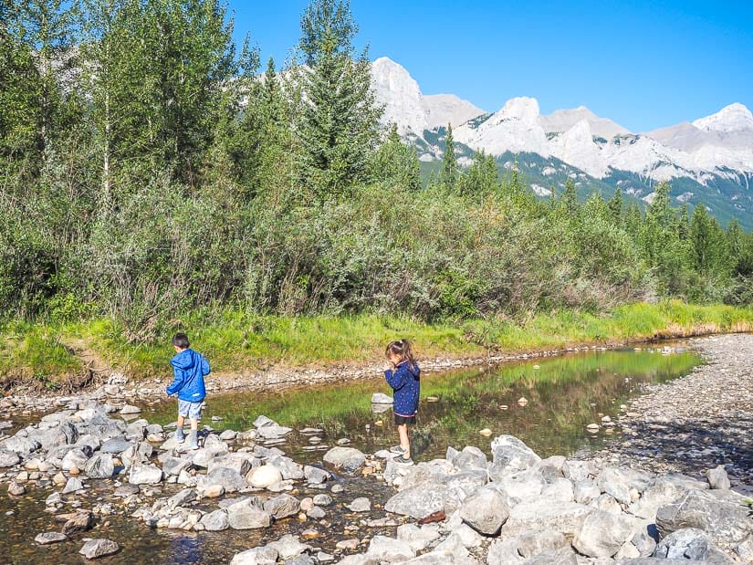
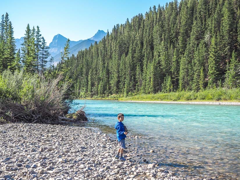
Walking south, the paved trail follows a small creek past some jealousy-inducing homes. It then meets a branch of the Bow River and follows it west on a dirt path onto Larch Islands, a delicate wetland area rich in plant and animal life. The trail is not paved, but most parts of it are wide and flat enough that they could accommodate most strollers.
Have you got kids as well? Check out my guides to visiting Banff with kids, Jasper with kids, Edmonton with kids, and Drumheller with kids.
Our kids especially enjoyed the part of the trail along the main Bow River, where there were lots of rocks to toss in. After that, the trail loops back toward the residential area at Larch Park Playground, where we stopped to play.
Although the trail never crosses the Bow River, Larch Islands are technically a part of Canmore Nordic Centre Provincial Park.
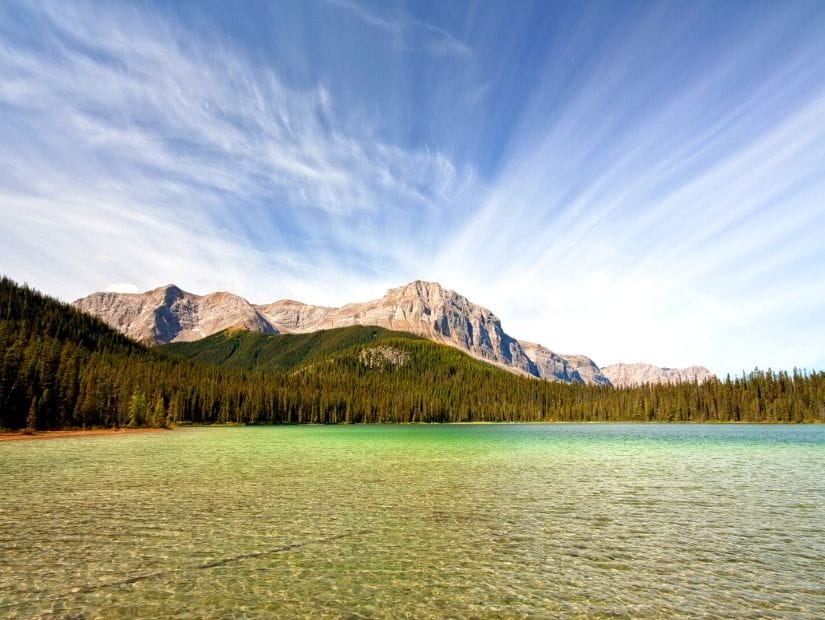
3. Grassi Lakes Trail
Distance: 4.3 km loop or out-and-back
Walking time: 2 hours
Difficulty: Easy – Moderate
Paved/Accessible: No
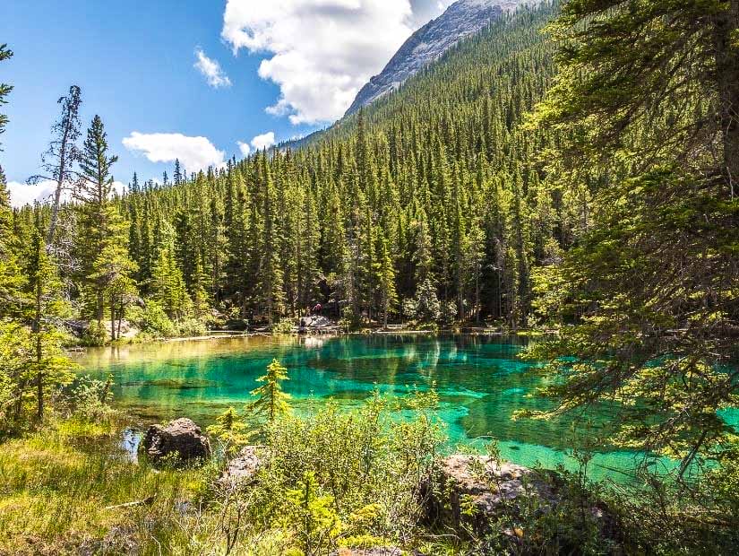
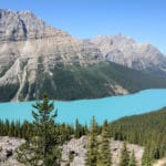
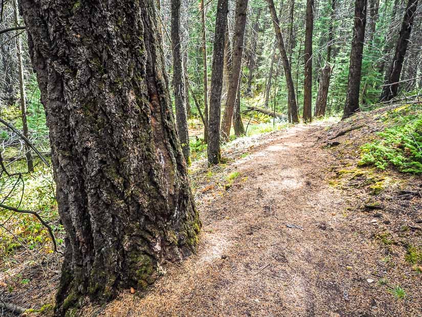
Grassi Lakes Trail is one of the most popular easy trails in Kananaskis. The trail leads through an evergreen forest to two small but incredibly beautiful, brilliantly-colored lakes, considered by many to be two of the most beautiful lakes in Kananaskis.
For families with young kids who are ready to try something a little bit longer and with a little more incline, this one is perfect.
While the trail map is shown as a loop, it essentially has an easier “Lower Trail” and a steeper “Upper Trail”. For an easier walk, take the Lower Trail there and back, or for a more difficult one, take the Upper trail both ways.
The Lower Trail is mostly gravel and is manageable with an all-terrain stroller.
Be warned that this hike is extremely popular, so the parking lot is usually overflowing at peak times.
If you love scenic lakes, then see my guides to the best easy-to-reach lakes in Jasper, easy-to-reach lakes in Banff, and Waterton Lakes National Park.
Easy Hikes in Bow Valley Provincial Park
Bow Valley Provincial Park is another small provincial park (33 km2) in Kananaskis. It is located east of Canmore, mostly on the flatlands and banks of the Bow River between Highway 1 (Trans-Canada Highway) and Highway 1A (Bow Valley Trail).
A few of the trails below also cross into Bow Valley Wildland Provincial Park, a much larger park (575 km2) with sections on both sides of the Bow River.
Because many of the below trails are located just off either highway, they are extremely convenient as quick hiking stops when traveling to or from Canmore, Banff, or BC. However, some of them, unfortunately, do experience some noise from the highway traffic.
4. Three Sisters Creek Trail
Distance: 3.4 km out-and-back
Walking time: 1.5 hours
Difficulty: Easy – Moderate
Paved/Accessible: No
Three Sisters Creek Trail is a lesser-known easy Kananaskis hike that begins in the Three Sisters Community (technically part of Canmore) and crosses into Bow Valley Wildland Provincial Park.
The trail follows Three Sisters Creek up the slope of Three Sisters mountain. It’s a steady, gentle uphill climb, gaining a few hundred meters in altitude in total. At the top, there’s a small waterfall on the creek.
This trail passes through a wildlife corridor, so it is especially important to be aware and bear-safe.
The trail is seldom busy, even on weekends, so it is perfect for a peaceful escape with kids. It’s only a few minutes’ drive off Highway 1 to the trailhead, but far enough that you won’t hear the traffic. There is space along the road for a few cars to park.
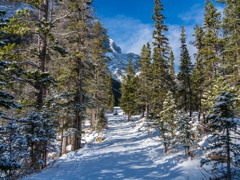
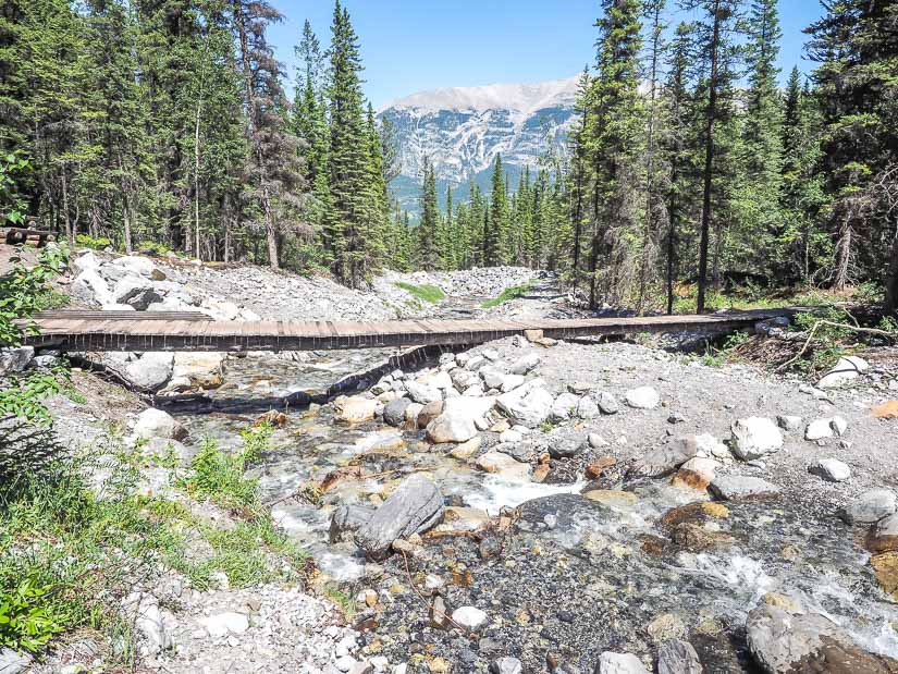
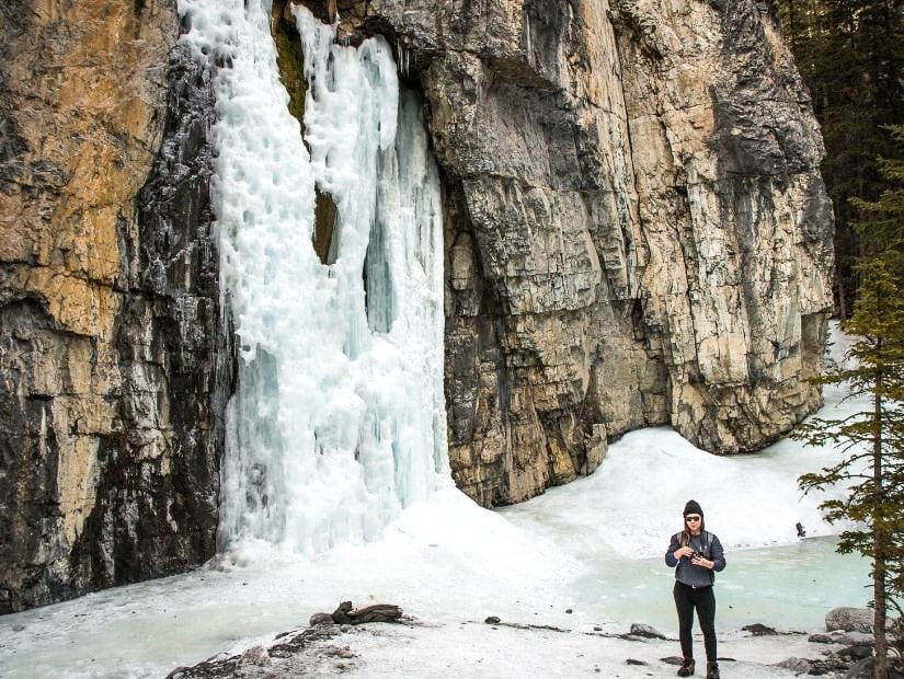
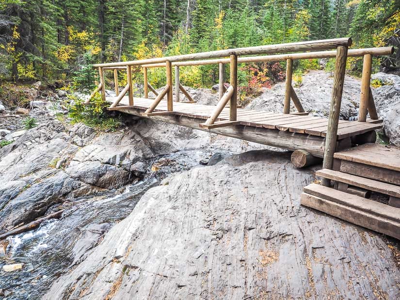
5. Grotto Canyon Trail
Distance: 7.1 km out-and-back
Walking time: 2.5 – 3 hours
Difficulty: Easy – Moderate
Paved/Accessible: No
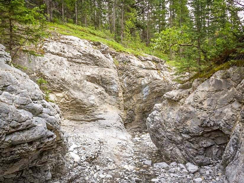
Along with Grassi Lakes, Grotto Canyon Trail is one of the most popular easy hikes in Kananaskis. Thus you can also expect crowds at this one, and it is better to avoid peak times.
While the trail itself is easy and mostly goes along a creek bed through a canyon, I’ve labeled it as easy – moderate because it is longer and sometimes requires careful steps over the rocks. For young kids this one can be a little tougher, but they seem to mostly love the challenge.
Some highlights of Grotto Canyon include several pictographs on the cliff walls, a waterfall, Inukshuk Garden, and Grotto Canyon Cave.
If you plan to visit the area in winter, also see my guides to visiting Banff in winter and Jasper in winter.
Grotto Canyon Trail is also one of the most popular easy winter hikes in Kananaskis, because hikers can walk on a frozen creek and see a frozen waterfall (see more frozen waterfalls in Alberta here!) However, the trail is definitely more difficult than usual at this, as it can be quite slippery. Cleats/crampons are necessary (our kids have little slip-on ones that we got at Mountain Equipment Co-Op).
In spring when the ice starts to melt, the trail can become very muddy and dangerous.
Grotto Canyon Trail starts on Highway 1A (Bow Valley Trail). The trail itself is technically part of Bow Valley Provincial Park, a super thin strip of the park that penetrates into a mountainous area that is otherwise not part of Kananaskis.
6. Heart Creek Trail & Heart Creek Bunker
Distance: 4.8 and 4.0 km out-and-back
Walking time: 1 – 1.5 hours each
Difficulty: Easy
Paved/Accessible: No
Heart Creek Trail and Heart Creek Bunker are two easy trails starting from Highway 1 (Trans-Canada Highway) about 10 minutes before it reaches Canmore. The former is in a park of its own, Heart Creek Provincial Recreation Area, while the latter goes into Bow Valley Wildland Provincial Park. Both trails start from the same parking lot.
The downside of these trails is that they are close to the highway so you can hear the traffic. Due to their convenient location along the highway, they can also be very busy.
On Heart Creek Trail, once the trail reaches the creek (about 10 minutes in) and follows it upstream, the traffic noise is replaced with the sound of the trickling stream. The trail crosses several small bridges, and there are some lovely little waterfalls.
Heart Creek Bunker trail mostly runs parallel to the highway, so it has traffic noise most of the way. It is a comparatively boring hike, but the prize at the end is a cool 55-meter deep Cold War-era bunker that you can go into. Bring a flashlight!
7. Flowing Water Interpretive Trail
Distance: 2.3 km loop
Walking time: 30 min – 1 hour
Difficulty: Very easy
Paved/Accessible: No
Flowing Water Interpretive Trail is a very easy and short Kananaskis hiking trail that begins at Willow Rock Campground in Bow Valley Provincial Park.
The campground and trail are located on a piece of land sandwiched between Highway 1 and Highway 1X (which connects to Highway 1A, Bow Valley Trail). It is named after the Kananaskis River, which the trail follows for a bit before the river empties into Bow River.
The dirt trail is almost totally flat, except for one small hill up to a bench and lookout point over Kananaskis River. After that, the trail goes through a marshy area with a small beaver pond.
To reach the loop trailhead, you need to park at the entrance to Willow Rock Campground and walk through part of the campground (take the road labelled ‘Lower Loop’). The trail starts between campsites 86 and 87.
Although they probably don’t want you to do this, if you come at a non-busy time and park in one of the campsites near the trailhead, you can make this hike even shorter (1.4 km, only 20-30 min).
The following 4 trails are all located in the main section of Bow Valley Provincial Park, on the flats between Highway 1 and Bow River. Bow Valley Campground and Elk Flats Group Campground are also located there.
All four hikes are connected with walking trails, so they could be combined into a longer, half-day (but still easy) hike.
8. Montane Trail (1.4 km)
Distance: 1.4 km loop
Walking time: 30 min – 1 hour
Difficulty: Very easy
Paved/Accessible: No
Montane Trail is a very easy (but I must admit, a little boring) walking trail that begins at Bow Valley Administration & Information Centre (not marked on GoogleMaps, but it’s the first parking lot you’ll see on the right when entering Bow Valley Provincial Park from Highway 1X).
The trail first crosses a meadow (watch for elk) then enters a montane (alpine) forest of Douglas fir and white spruce trees. There are interpretive signs throughout.
The trees are the main event here; there are no lakes, rivers, or impressive mountain views. The walk is peaceful and very easy, though, with only some very gentle up and down, and there are lots of squirrels & birds. There’s a sign indicating the trailhead in the parking lot, behind the outhouse.
9. Middle Lake Trail
Distance: 2.3 km loop
Walking time: 45 min – 1 hour
Difficulty: Easy
Paved/Accessible: No
The next easy hiking opportunity you’ll encounter, five minutes’ drive further into Bow Valley PP from Montaine Trail, is Middle Lake Trail.
For this one, the best part is right at the start of the trail, only two minutes’ walk from the parking lot.
This is a view looking down on Middle Lake, with a placard explaining in detail how the lake was formed by receding glaciers (it is technically a kettle).
If you want to do the full hike, it is an easy stroll mostly through the forest (no lake views), and with only one section that is slightly steep.
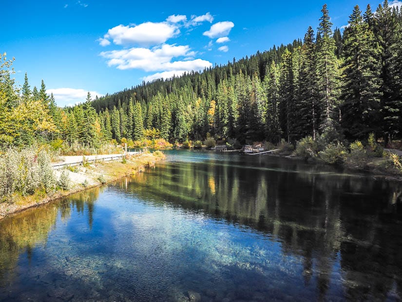
10. Many Springs Interpretive Trail
Distance: 1.6 km loop
Walking time: 30 min – 1 hour
Difficulty: Very easy
Paved/Accessible: No
Another five minutes’ drive past Middle Lake brings visitors to Many Springs Trail, an easy loop trail around a small spring-fed lake.
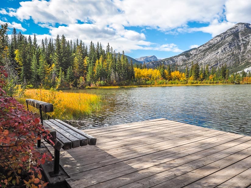
The trail goes straight for five minutes then you can choose to go left (clockwise) or right (counterclockwise) around the lake. Whichever one you choose, you’ll reach a lookout point over the lake with a dock (left side) or small boardwalk and bridge (right side) about a quarter way around the lake.
There’s minimal up and down on this one, so it’s a good option for young kids or anyone looking for a very casual stroll.
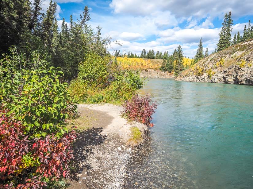
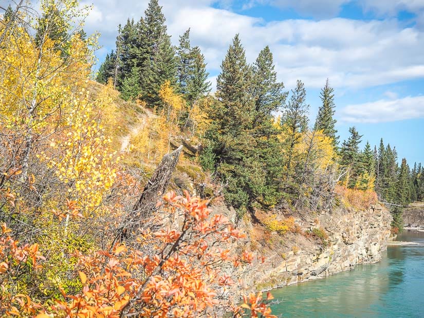
11. Bow River Trail
Distance: 3.7 km out-and-back
Walking time: 1 hour or less
Difficulty: Very easy
Paved/Accessible: No
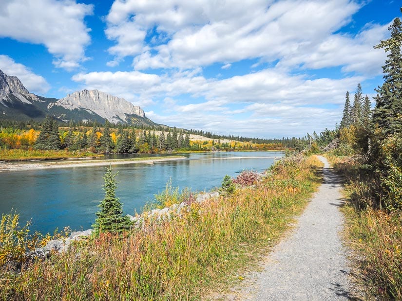
The last easy Kananaskis walk in Bow Valley Provincial Park is Bow River Trail. The trail starts at Whitefish Day Use Area, which has some lovely picnic spots by the Bow River.
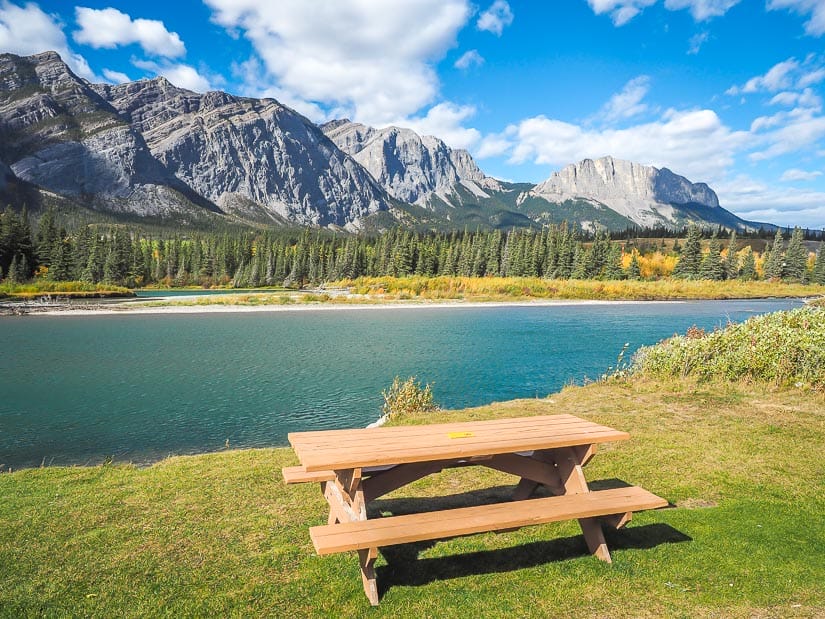
From there, it follows Bow River downstream, passing right along the back of several campsites in Bow Valley Campground. You will be simultaneously obsessed with the Bow River views and jealous of those camping along the way.
Across the Bow River, Loder Peak, Old Goat Mountain, and sheer-faced Mt. Yamnuska dominate the view. The dirt trail is narrow but with virtually no uphill or downhill, and plenty of shade from riverside trees. As an out-and-back, it’s also nice that you can go as far as you want and then turn back.
Easy Hikes on Kananaskis Trail
Highway 40 (Kananaskis Trail) travels south from Highway 1 into the heart of Kananaskis, the perfect region for epic road trips such as these.
The trail meanders through a number of provincial, wildland, and recreation parks, including Bow Valley, Sibbald, Evan Thomas, Elbow Sheep, and over Highwood Pass (the highest paved pass in Canada) to Peter Lougheed, Don Getty, and Highwood. Exploring these parks, it’s easy to see why Alberta is considered Canada’s prettiest province.
Most of the easy Kananaskis trails along this route are in the first 70 kilometers (one hour driving time) of it, with several of them being very close to Kananaskis Village.
If you are staying in the cluster of hotels at Kananaskis Village (I recommend HI Kananaskis Wilderness Hostel or Kananaskis Mountain Lodge, famous for its Nordic Spa), there are also some very easy walks in and around town that I haven’t included here.
12. Widow Maker Trail
Distance: 4.5 km one-way
Walking time: 1.5 hours (3 hours return)
Difficulty: Easy
Paved/Accessible: No
Don’t be scared off by the name; Widow Maker is an exhilarating portion of the Kananaskis River that people kayak down, not the trail named after it.
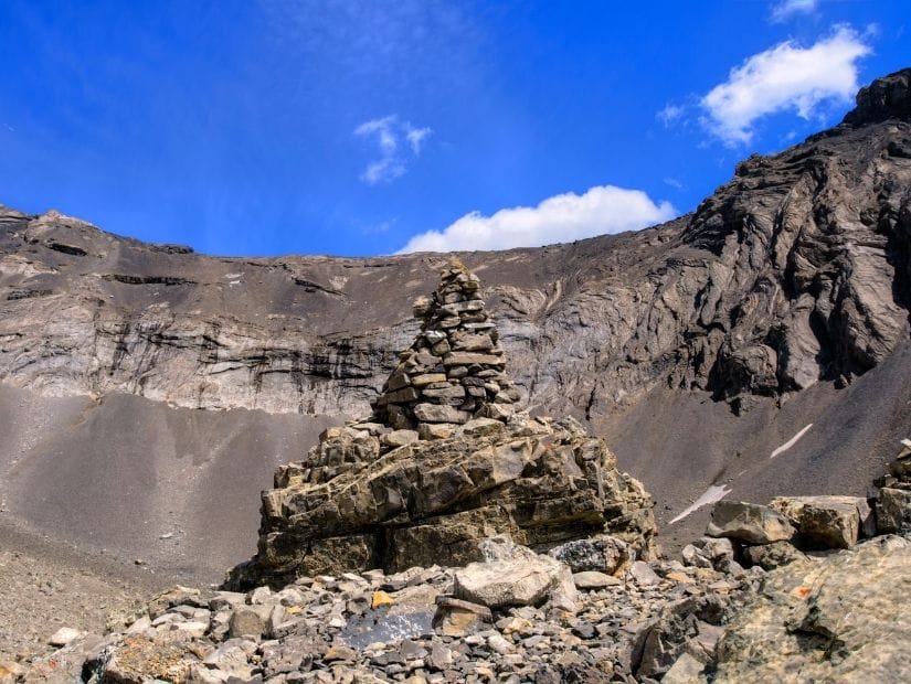
Widow Maker Trail is a one-way trail from Canoe Meadows, a popular spot for people to start or end canoe/kayak/rafting ventures, to Widow Maker, a narrow section where you can walk out onto a rocky promontory (image below). Canoe Meadows is the first major stop on Kananaskis Trail.
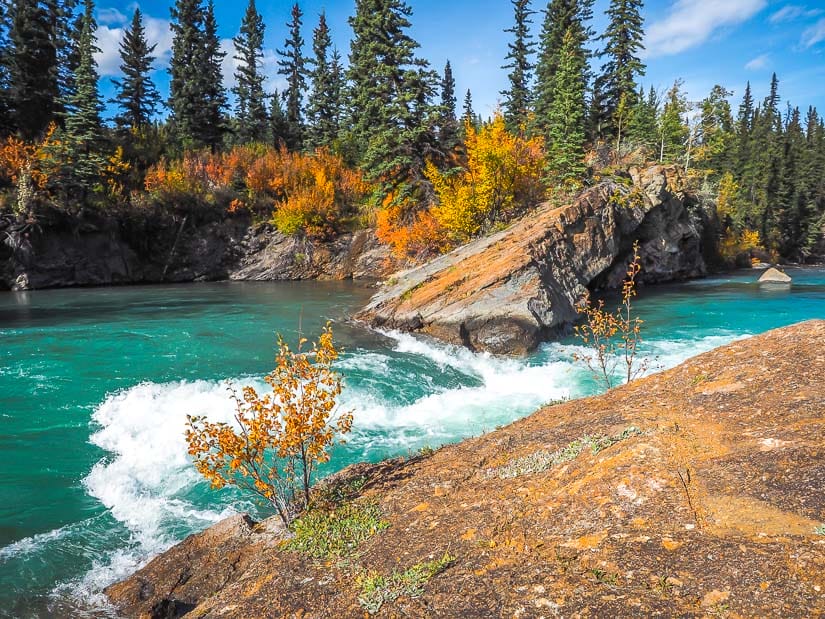
There’s only a bit of up-and-down on this one, with fine river views throughout. Just keep in mind that you’ll have to return to the same spot, so it’s a little longer to complete the return hike (pushing this hike into moderate territory), unless you can park a second car at the other end.
There’s also a campground at Canoe Meadows, which requires advance reservation. Kananaskis Visitor Information Centre is on the highway between Canoe Meadows and Widow Maker.
13. Mount Lorette Ponds Trail
Distance: 1 km loop
Walking time: 15 – 30 minutes
Difficulty: Extremely easy
Paved/Accessible: Yes
Mt. Lorett Ponds Trail is probably the best and most scenic stroller-friendly and wheelchair-accessible walking trail in Kananaskis.
A totally flat, paved trail leads from the parking lot to the gorgeous, mountain-backed ponds, doing a loop around them. There is a wheelchair-friendly ramp onto a viewing dock on the opposite side, and a few bridges over the ponds.
At the far end, a trail leads to another dock, and there are several secluded picnic sites around the ponds. The picnic spots closest to the parking lot also have fire pits.
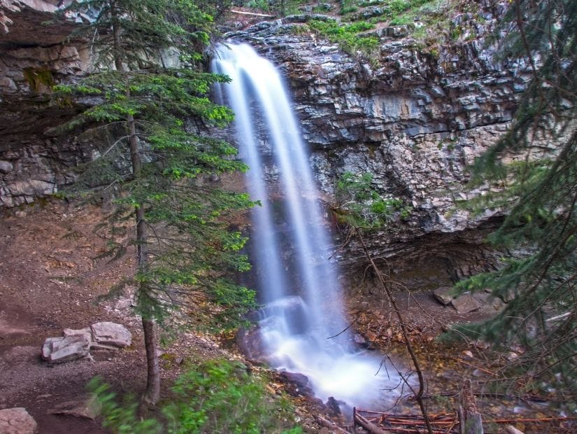
14. Troll Falls (3.4km)
Distance: 3.4 km out-and-back or loop
Walking time: 1.5 – 2 hours
Difficulty: Easy (with optional moderate add-on)
Paved/Accessible: No
The trail to Troll Falls is one of the most popular easy Kananaskis hikes, right up there with Grassi Lakes and Grotto Canyon. This is due in part to the fact that it is so close to Kananaskis Village and Nakiska Ski Area.
The highlight of the trail is Troll Falls itself. Another interesting spot, especially for kids, is a Golden Eagle migration Count Site along the trail.
The trail has only some mild up-and-down. After Troll Falls, you can do a 1-km, steeper extension to Troll Middle Falls (which you can climb behind) and Upper Falls.
Instead of retracing your steps to return, you can walk back via Stoney Trail (only 0.1 km longer) or Hay Meadows (0.2 km longer), which both have less crowds than the main trail.
Note that as of late summer 2021, Troll Falls Trail was closed due to construction in the parking lot area.
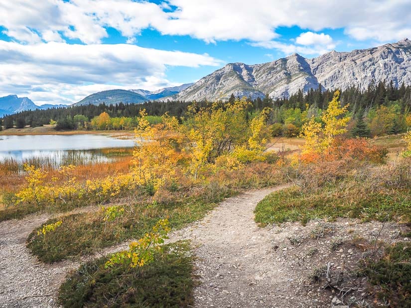
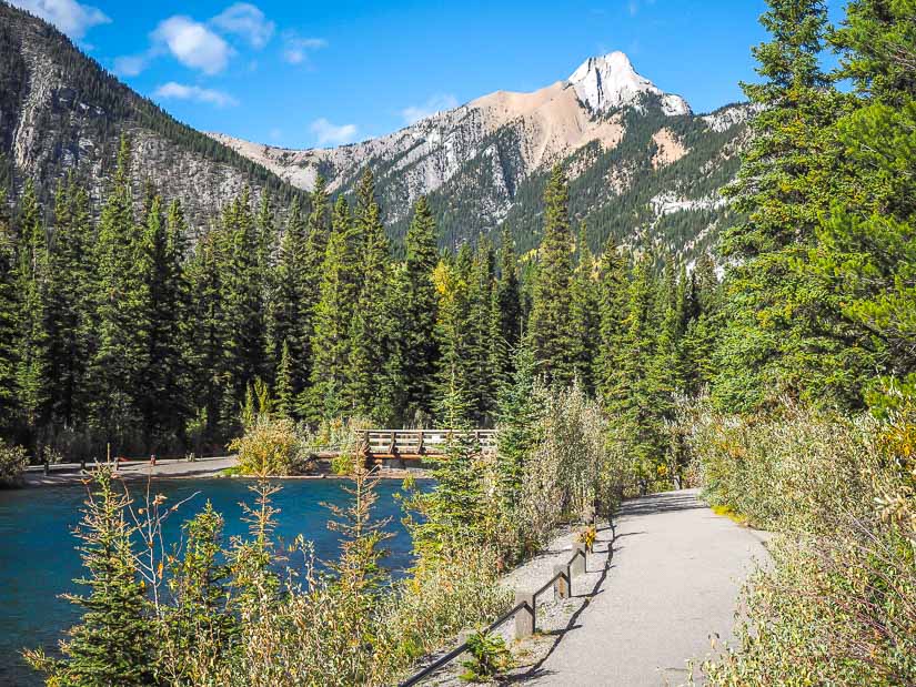
15. Wedge Pond Loop Trail
Distance: 1 km loop
Walking time: 20 – 45 min
Difficulty: Very easy
Paved/Accessible: No
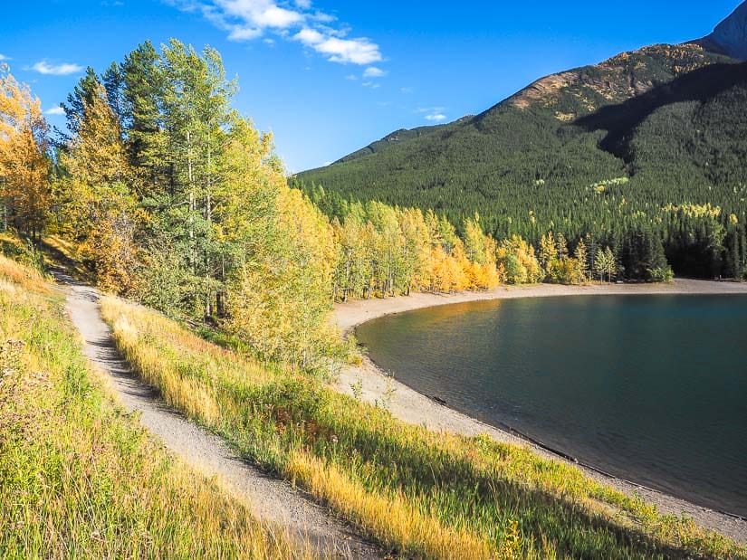
Wedge Pond is a beautiful little spring and meltwater-fed lake at the base of The Wedge mountain.
From the parking lot, a series of trails descend past some leafy picnic spots to the very easy and almost totally flat loop trail around the lake.
The trail goes through the woods just off the shore, or you can walk around the whole like on the shore itself. The best views are halfway around, from where several peaks are visible in the background.
The trail is particularly lovely in fall, with bright yellow foliage on the trees at the shore, and larch trees visible high up on the mountains behind the lake.
Wedge Pond is just off Highway 40 (left side) when traveling south, just a few minutes after the turnoff for Kananaskis Village (right side).
Easy Hikes in Elbow Sheep and Peter Lougheed
Continuing south from Wedge Pond, Highway 40 soon reaches the turnoff for Highway 742 (Smith Dorrien Trail), a slow-moving and very dusty gravel road that does a big loop all the way back to Canmore.
The first three hikes below are on Highway 40 if you continue driving south past the turnoff for the 742. The three hikes after that are located on the 742, but only a short ways in.
Note that Highway 742 often closes in winter due to risk of avalanche, as does Highway 40 south of the 742 turnoff, so the hikes listed in this section may not be accessible from December 1 to June 1. Always double check current closures before going.
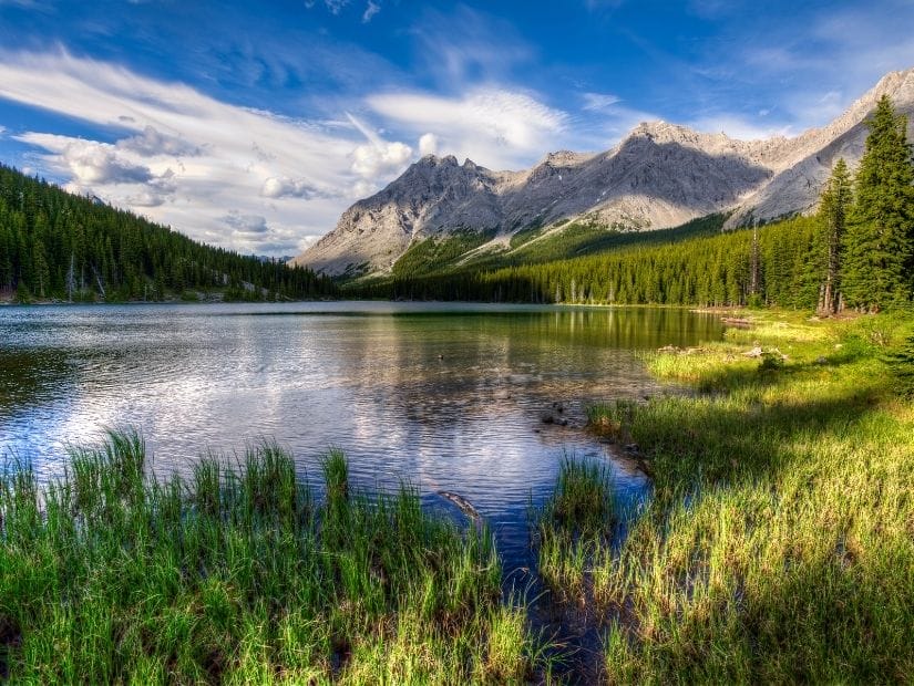
16. Elbow Lake Loop
Distance: 4.2 out-and-back + loop around lake
Walking time: 1.5 – 2 hours
Difficulty: Easy – moderate
Paved/Accessible: No
The trail to Elbow Lake is the first easy hike on Highway 40 after it passes the turnoff for Highway 742. It is located in Elbow Sheep Wildland Provincial Park.
What makes this trail closer to moderate is that it travels steadily uphill for the first portion up to the lake. Once you reach Elbow Lake, the loop trail around it is pretty much flat.
The highlight of the trail is the pretty lake itself, which has several spots to relax and a small backcountry campground with toilet. The trail up to the lake is wide, so families can walk side-by-side rather than single file.
For the more ambitious, you can continue 2.7 km further to Rae Glacier, while the less ambitious can make this hike shorter by not doing the loop around the lake (although this is the best part).
17. Highwood Pass Interpretive Trail
Distance: 1.3 km out-and-back
Walking time: 15 – 30 min
Difficulty: Extremely Easy
Paved/Accessible: Partially
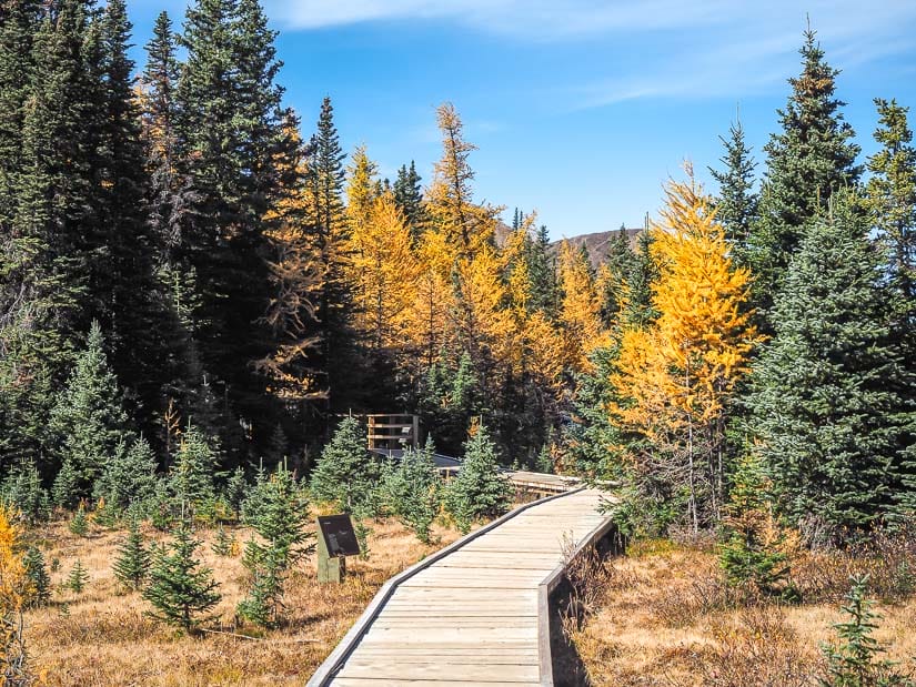
Highwood Pass Interpretive Trail is located on Highwood Meadows, right beside Highwood Pass, the highest paved road in all of Canada.
The dirt and boardwalk trail traverses a fragile alpine meadow. People with strollers should have no issue with this trail, but parts of it are a little bumpy.
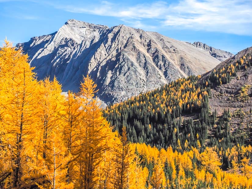
In late September, it is one of the few spots where you get close to tamarack (larch) trees when they turn yellow without having to hike up a difficult trail.
However, if you come during larch season, the parking lot at Highwood Pass/Meadows will be extremely busy, because this trail is also the starting point of some very popular longer hikes: Ptarmigan Cirque (see below) and the more difficult Pocaterra Cirque & Pocaterra Ridge.
While Pocaterra Cirque and Pocaterra Ridge are rated as medium and difficult, respectively, if you only walk up to the larch forest (30 min – 1 hour one-way, same route for both hikes), I’d rate that first section as easy – moderate. Why do it? Well, the larch viewing on this hike is even better than on Ptarmigan Cirque or any others in the area, because you’ll be walking right through larch forests rather than seeing them from afar!
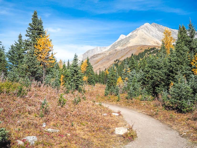
18. Ptarmigan Cirque
Distance: 3.5 km out-and-back with loop in cirque
Walking time: 1.5 – 2 hours
Difficulty: Easy – Moderate
Paved/Accessible: No
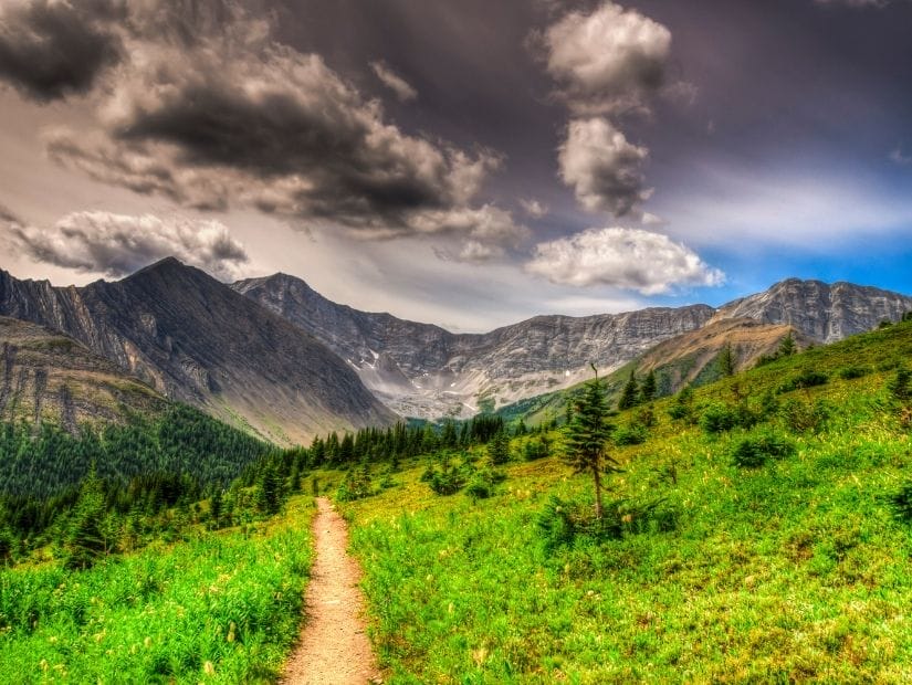
Starting from the same parking lot, the trail to Ptarmigan Cirque follows the start of the Highwood Pass Interpretive Trail then crosses the highway before making it’s way up to the cirque.
Ptarmigan Cirque is widely known as a good Kananaskis hike for families and young kids, so you can expect to see lots of them. For comparatively little effort, hikers are able to enjoy high mountain views and gorgeous mountain scenery from the cirque. This one does border on moderate, though, as it involves 250 meters or elevation gain, and is a little steep in spots.
In larch season (late September), this is one of the most famous larch viewing trails, so you can expect it to be extremely busy, and the parking lot (which also serves Pocaterra Ridge/Cirque, an even better but more difficult larch hike) to be overflowing, and you’ll need to park along the highway.
Note that grizzly sightings are common on this trail and other trails around Highwood Pass.
19. Rockwall Lake Trail
Distance: 0.5 km loop
Walking time: 10 – 15 min
Difficulty: Extremely easy
Paved/Accessible: Yes
From the Peter Lougheed Discovery and Information Centre, a paved, accessible loop trail leads to a lookout point over Rockwall Lake (technically a fen, or marsh).
I don’t have a photo of this one because at the time of my visit, Peter Lougheed Discovery and Information Centre and Rockwall Trail had been closed to the public due to a high level of grizzly bear activity.
20. Marl Lake Trail
Distance: 3.2 km loop
Walking time: 1 – 1.5 hours
Difficulty: Easy
Paved/Accessible: Partially
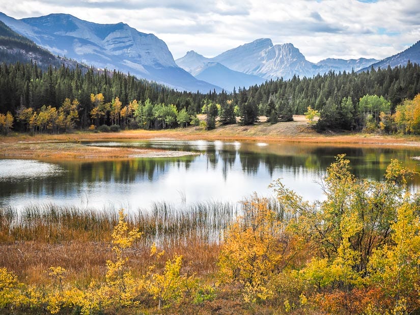
Marl Lake Trail is a quiet, low traffic trail from Kananaskis Lakes Road to small, pretty Marl Lake. The trail passes by Elkwood Campground before reaching the shore of the lake, but does not go around the lake.
The trail is wide and paved in parts, but also has some stairs and small wooden bridges. Therefore, you could take bikes or even a stroller on it, but you may have to lift or carry them at certain parts.
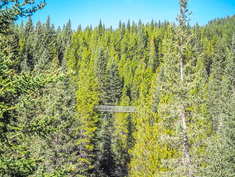
21. Blackshale Creek Suspension Bridge
Distance: 1 km loop
Walking time: 20 – 40 min
Difficulty: Easy
Paved/Accessible: No
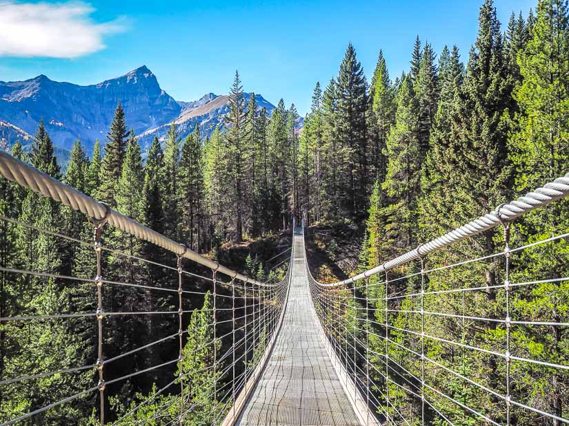
Blackshale Creek Suspension Bridge is a classic hanging suspension bridge across a valley formed by Blackshale Creek.
The wide trail up to one end of the bridge and back down to the highway from the other end of the bridge is a little steep but very short.
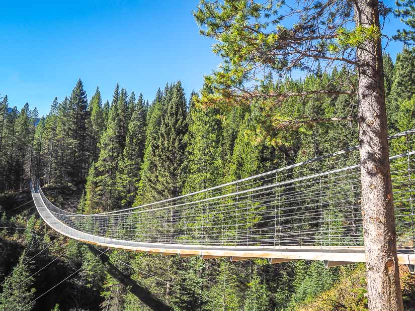
The trailhead is unmarked, you can’t see the bridge from the road, and there’s no phone signal in the area. Therefore, I recommend downloading a map that works with GPS when your phone is offline. It’s just five minutes’ drive up Highway 742 past Lower Kananaskis Lake; there are usually some cars parked there, but don’t count on it.
There’s also a longer hike to the bridge from the parking lot at Black Prince (see next entry), but I recommend just doing this shorter one.
22. Black Prince Trail & Warpsite Lake
Distance: 4.5 km out-and-back
Walking time: 1.5 – 2 hours
Difficulty: Easy
Paved/Accessible: No
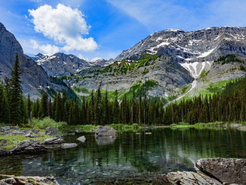
Black Prince Trail starts from a marked parking lot a few minutes’ drive past the trailhead for Blackshale Creek Suspension Bridge.
It’s an easy trail with some gentle up-and-down, and gorgeous mountain scenery along the way. The trail ends at Warpsite Lake, which is quite pretty when it’s there, but tends to mostly dry up by late summer.
Heads up that bear sightings are common in the area. In larch season, you can see some larches at the lake if you go off the trail and walk around the right side of the lake.
Easy Hikes in Spray Valley Provincial Park
If you decide to continue driving along Highway 742 all the way back to Canmore (most people take Highway 40 back, which is paved and much faster), there is one more easy hike worth considering.
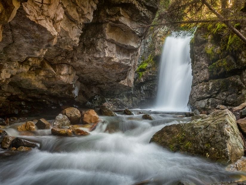
23. Watridge Lake Trail
Distance: 8.2 km out-and-back
Walking time: 2 – 3 hrs
Difficulty: Easy – Moderate
Paved/Accessible: No
This trail follows a wide, gravel logging road to lovely Watridge Lake. With only some gentle up-and-down, it is definitely an easy walk, but I rate it as easy-moderate due to the length.
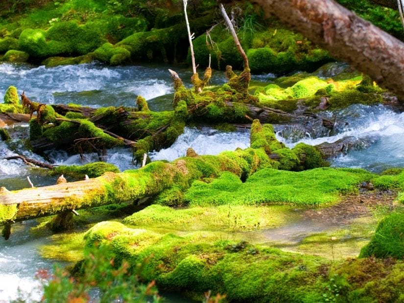
Just before the lake, there is a turnoff for an highly recommended add-on: a 1.6 km (return) side trail to Karst Spring. Follow Karst Spring Waterfall up to the water source at the top. It’s highly scenic but fairly steep, pushing this hike to moderate difficulty.
Watridge Trail is just before Spray Lakes Reservoir, which is formed by the damning of Spray River, a tributary of Bow River.
Another hike worth nearby is the popular Chester Lake Trail, but this hike is rated as moderate so I won’t cover it here.
Well, that brings us to the end of this list of the easiest hikes and walks in Kananaskis. I really enjoyed trying out most of these hikes as I put it together. I hope you’ve found just the right easy Kananaskis hike for you!